You are here: Home > Network List > IU - Global Seismograph Network (GSN - IRIS/USGS) Stations List
> Station CTAO Charters Towers, Australia > Earthquake Result Viewer
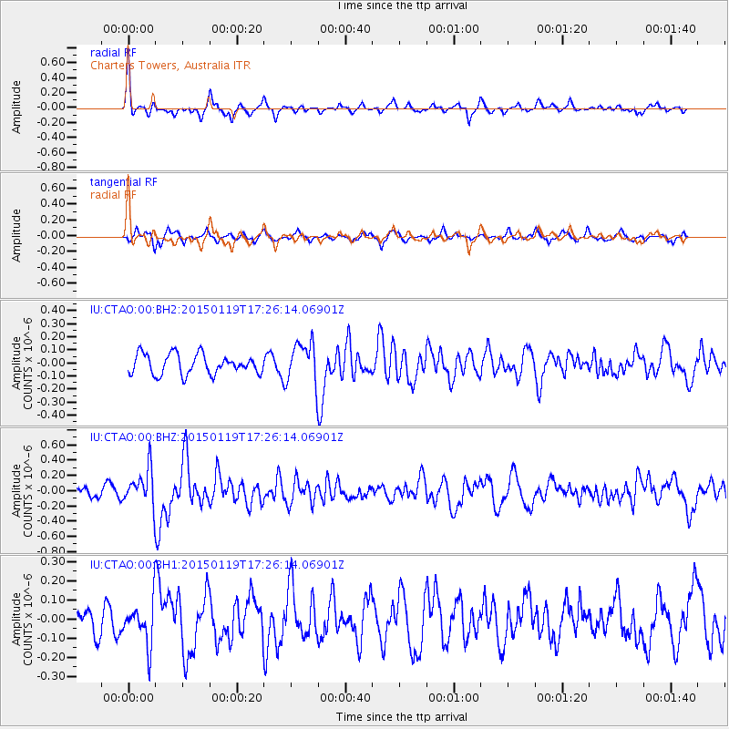
CTAO Charters Towers, Australia - Earthquake Result Viewer
*The percent match for this event was below the threshold and hence no stack was calculated.
| Earthquake location: |
Sulu Archipelago, Philippines |
| Earthquake latitude/longitude: |
4.6/119.8 |
| Earthquake time(UTC): |
2015/01/19 (019) 17:19:45 GMT |
| Earthquake Depth: |
11 km |
| Earthquake Magnitude: |
5.5 MWB |
| Earthquake Catalog/Contributor: |
NEIC PDE/NEIC COMCAT |
|
| Network: |
IU Global Seismograph Network (GSN - IRIS/USGS) |
| Station: |
CTAO Charters Towers, Australia |
| Lat/Lon: |
20.09 S/146.25 E |
| Elevation: |
357 m |
|
| Distance: |
35.8 deg |
| Az: |
134.197 deg |
| Baz: |
310.506 deg |
| Ray Param: |
$rayparam |
*The percent match for this event was below the threshold and hence was not used in the summary stack. |
|
| Radial Match: |
78.10656 % |
| Radial Bump: |
376 |
| Transverse Match: |
67.44766 % |
| Transverse Bump: |
383 |
| SOD ConfigId: |
837871 |
| Insert Time: |
2015-02-02 17:32:58.998 +0000 |
| GWidth: |
2.5 |
| Max Bumps: |
400 |
| Tol: |
0.001 |
|
Signal To Noise
| Channel | StoN | STA | LTA |
| IU:CTAO:00:BHZ:20150119T17:26:14.06901Z | 2.7480876 | 2.395272E-7 | 8.716141E-8 |
| IU:CTAO:00:BH1:20150119T17:26:14.06901Z | 1.6656626 | 1.14111415E-7 | 6.850812E-8 |
| IU:CTAO:00:BH2:20150119T17:26:14.06901Z | 2.048031 | 1.5455944E-7 | 7.5467334E-8 |
| Arrivals |
| Ps | |
| PpPs | |
| PsPs/PpSs | |


