You are here: Home > Network List > IU - Global Seismograph Network (GSN - IRIS/USGS) Stations List
> Station GNI Garni, Armenia > Earthquake Result Viewer
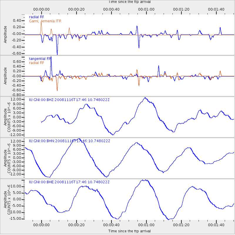
GNI Garni, Armenia - Earthquake Result Viewer
*The percent match for this event was below the threshold and hence no stack was calculated.
| Earthquake location: |
Minahassa Peninsula, Sulawesi |
| Earthquake latitude/longitude: |
1.3/122.1 |
| Earthquake time(UTC): |
2008/11/16 (321) 17:34:38 GMT |
| Earthquake Depth: |
35 km |
| Earthquake Magnitude: |
5.6 MB |
| Earthquake Catalog/Contributor: |
WHDF/NEIC |
|
| Network: |
IU Global Seismograph Network (GSN - IRIS/USGS) |
| Station: |
GNI Garni, Armenia |
| Lat/Lon: |
40.15 N/44.74 E |
| Elevation: |
1609 m |
|
| Distance: |
79.5 deg |
| Az: |
310.478 deg |
| Baz: |
97.203 deg |
| Ray Param: |
$rayparam |
*The percent match for this event was below the threshold and hence was not used in the summary stack. |
|
| Radial Match: |
77.97915 % |
| Radial Bump: |
400 |
| Transverse Match: |
94.305275 % |
| Transverse Bump: |
316 |
| SOD ConfigId: |
2658 |
| Insert Time: |
2010-03-03 13:53:26.276 +0000 |
| GWidth: |
2.5 |
| Max Bumps: |
400 |
| Tol: |
0.001 |
|
Signal To Noise
| Channel | StoN | STA | LTA |
| IU:GNI:00:BHN:20081116T17:46:10.748022Z | 3.5802596 | 1.4242715E-5 | 3.978124E-6 |
| IU:GNI:00:BHE:20081116T17:46:10.748022Z | 0.6086189 | 3.041418E-6 | 4.9972455E-6 |
| IU:GNI:00:BHZ:20081116T17:46:10.748022Z | 1.2402991 | 3.8959165E-6 | 3.1411105E-6 |
| Arrivals |
| Ps | |
| PpPs | |
| PsPs/PpSs | |


