You are here: Home > Network List > IU - Global Seismograph Network (GSN - IRIS/USGS) Stations List
> Station PMG Port Moresby, New Guinea > Earthquake Result Viewer
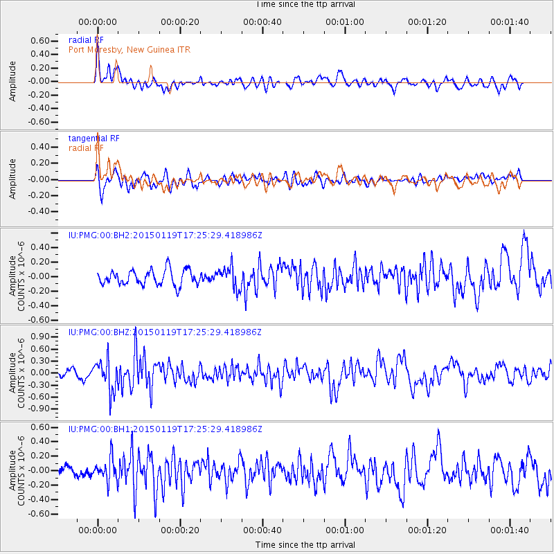
PMG Port Moresby, New Guinea - Earthquake Result Viewer
*The percent match for this event was below the threshold and hence no stack was calculated.
| Earthquake location: |
Sulu Archipelago, Philippines |
| Earthquake latitude/longitude: |
4.6/119.8 |
| Earthquake time(UTC): |
2015/01/19 (019) 17:19:45 GMT |
| Earthquake Depth: |
11 km |
| Earthquake Magnitude: |
5.5 MWB |
| Earthquake Catalog/Contributor: |
NEIC PDE/NEIC COMCAT |
|
| Network: |
IU Global Seismograph Network (GSN - IRIS/USGS) |
| Station: |
PMG Port Moresby, New Guinea |
| Lat/Lon: |
9.40 S/147.16 E |
| Elevation: |
90 m |
|
| Distance: |
30.7 deg |
| Az: |
117.061 deg |
| Baz: |
295.895 deg |
| Ray Param: |
$rayparam |
*The percent match for this event was below the threshold and hence was not used in the summary stack. |
|
| Radial Match: |
72.66461 % |
| Radial Bump: |
400 |
| Transverse Match: |
67.99415 % |
| Transverse Bump: |
400 |
| SOD ConfigId: |
837871 |
| Insert Time: |
2015-02-02 17:33:13.987 +0000 |
| GWidth: |
2.5 |
| Max Bumps: |
400 |
| Tol: |
0.001 |
|
Signal To Noise
| Channel | StoN | STA | LTA |
| IU:PMG:00:BHZ:20150119T17:25:29.418986Z | 4.2428565 | 3.9380348E-7 | 9.2815654E-8 |
| IU:PMG:00:BH1:20150119T17:25:29.418986Z | 1.5731422 | 1.539664E-7 | 9.787189E-8 |
| IU:PMG:00:BH2:20150119T17:25:29.418986Z | 1.4912999 | 1.5369153E-7 | 1.0305877E-7 |
| Arrivals |
| Ps | |
| PpPs | |
| PsPs/PpSs | |


