You are here: Home > Network List > TA - USArray Transportable Network (new EarthScope stations) Stations List
> Station 435B Jarrell, TX, USA > Earthquake Result Viewer
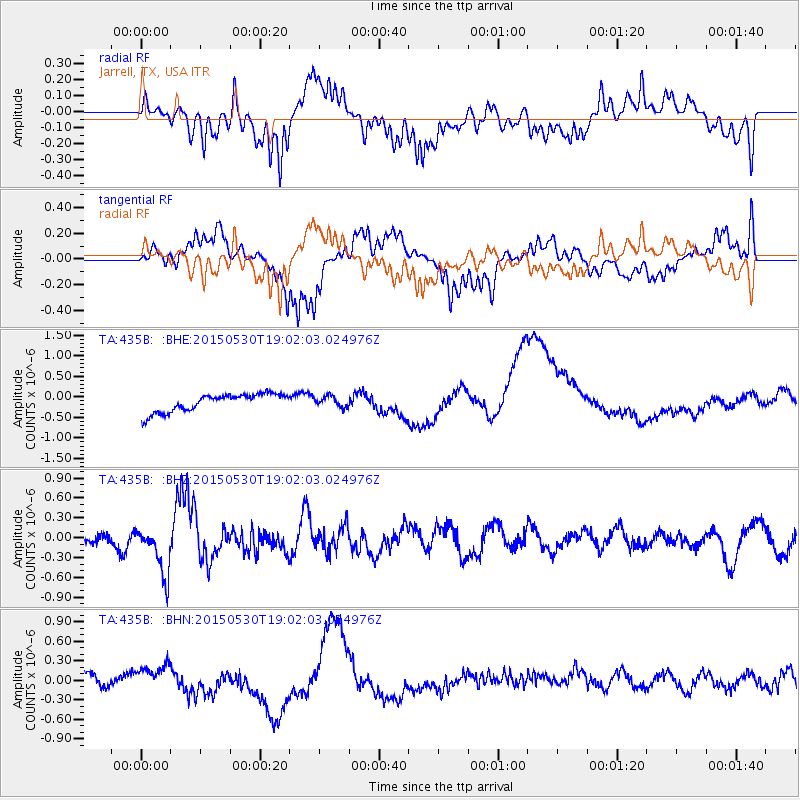
435B Jarrell, TX, USA - Earthquake Result Viewer
*The percent match for this event was below the threshold and hence no stack was calculated.
| Earthquake location: |
Southeast Of Honshu, Japan |
| Earthquake latitude/longitude: |
30.8/143.0 |
| Earthquake time(UTC): |
2015/05/30 (150) 18:49:07 GMT |
| Earthquake Depth: |
13 km |
| Earthquake Magnitude: |
6.4 MO |
| Earthquake Catalog/Contributor: |
NEIC PDE/NEIC ALERT |
|
| Network: |
TA USArray Transportable Network (new EarthScope stations) |
| Station: |
435B Jarrell, TX, USA |
| Lat/Lon: |
30.78 N/97.58 W |
| Elevation: |
248 m |
|
| Distance: |
96.0 deg |
| Az: |
48.933 deg |
| Baz: |
311.057 deg |
| Ray Param: |
$rayparam |
*The percent match for this event was below the threshold and hence was not used in the summary stack. |
|
| Radial Match: |
34.12983 % |
| Radial Bump: |
400 |
| Transverse Match: |
42.898834 % |
| Transverse Bump: |
371 |
| SOD ConfigId: |
7422571 |
| Insert Time: |
2019-04-19 03:49:13.301 +0000 |
| GWidth: |
2.5 |
| Max Bumps: |
400 |
| Tol: |
0.001 |
|
Signal To Noise
| Channel | StoN | STA | LTA |
| TA:435B: :BHZ:20150530T19:02:03.024976Z | 3.7382858 | 3.6340734E-7 | 9.721229E-8 |
| TA:435B: :BHN:20150530T19:02:03.024976Z | 0.98084587 | 1.4160369E-7 | 1.4436895E-7 |
| TA:435B: :BHE:20150530T19:02:03.024976Z | 0.5777502 | 1.2737911E-7 | 2.2047436E-7 |
| Arrivals |
| Ps | |
| PpPs | |
| PsPs/PpSs | |


