You are here: Home > Network List > IU - Global Seismograph Network (GSN - IRIS/USGS) Stations List
> Station GNI Garni, Armenia > Earthquake Result Viewer
GNI Garni, Armenia - Earthquake Result Viewer
*The percent match for this event was below the threshold and hence no stack was calculated.
| Earthquake location: |
Banda Sea |
| Earthquake latitude/longitude: |
-7.4/124.7 |
| Earthquake time(UTC): |
2008/12/06 (341) 10:55:27 GMT |
| Earthquake Depth: |
405 km |
| Earthquake Magnitude: |
6.1 MB, 6.4 MW, 6.4 MW |
| Earthquake Catalog/Contributor: |
WHDF/NEIC |
|
| Network: |
IU Global Seismograph Network (GSN - IRIS/USGS) |
| Station: |
GNI Garni, Armenia |
| Lat/Lon: |
40.15 N/44.74 E |
| Elevation: |
1609 m |
|
| Distance: |
87.1 deg |
| Az: |
310.905 deg |
| Baz: |
102.061 deg |
| Ray Param: |
$rayparam |
*The percent match for this event was below the threshold and hence was not used in the summary stack. |
|
| Radial Match: |
66.58716 % |
| Radial Bump: |
400 |
| Transverse Match: |
53.68177 % |
| Transverse Bump: |
400 |
| SOD ConfigId: |
2658 |
| Insert Time: |
2010-03-03 13:54:36.254 +0000 |
| GWidth: |
2.5 |
| Max Bumps: |
400 |
| Tol: |
0.001 |
|
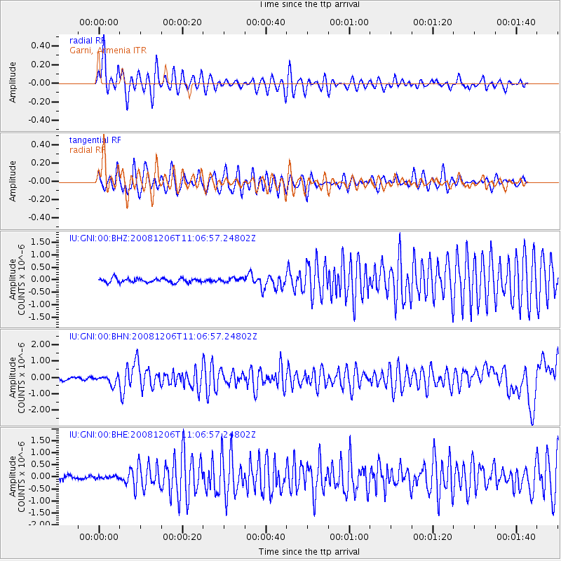
Signal To Noise
| Channel | StoN | STA | LTA |
| IU:GNI:00:BHN:20081206T11:06:57.24802Z | 3.1677778 | 2.715576E-7 | 8.5724956E-8 |
| IU:GNI:00:BHE:20081206T11:06:57.24802Z | 0.41900998 | 5.1661335E-8 | 1.232938E-7 |
| IU:GNI:00:BHZ:20081206T11:06:57.24802Z | 0.96955657 | 8.085388E-8 | 8.3392635E-8 |
| Arrivals |
| Ps | |
| PpPs | |
| PsPs/PpSs | |


