You are here: Home > Network List > TA - USArray Transportable Network (new EarthScope stations) Stations List
> Station G03D McMinnville, OR, USA > Earthquake Result Viewer
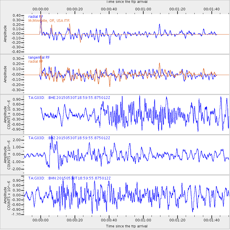
G03D McMinnville, OR, USA - Earthquake Result Viewer
*The percent match for this event was below the threshold and hence no stack was calculated.
| Earthquake location: |
Southeast Of Honshu, Japan |
| Earthquake latitude/longitude: |
30.8/143.0 |
| Earthquake time(UTC): |
2015/05/30 (150) 18:49:07 GMT |
| Earthquake Depth: |
13 km |
| Earthquake Magnitude: |
6.4 MO |
| Earthquake Catalog/Contributor: |
NEIC PDE/NEIC ALERT |
|
| Network: |
TA USArray Transportable Network (new EarthScope stations) |
| Station: |
G03D McMinnville, OR, USA |
| Lat/Lon: |
45.21 N/123.26 W |
| Elevation: |
222 m |
|
| Distance: |
71.3 deg |
| Az: |
48.134 deg |
| Baz: |
294.931 deg |
| Ray Param: |
$rayparam |
*The percent match for this event was below the threshold and hence was not used in the summary stack. |
|
| Radial Match: |
73.08441 % |
| Radial Bump: |
400 |
| Transverse Match: |
61.69445 % |
| Transverse Bump: |
400 |
| SOD ConfigId: |
7422571 |
| Insert Time: |
2019-04-19 03:49:30.867 +0000 |
| GWidth: |
2.5 |
| Max Bumps: |
400 |
| Tol: |
0.001 |
|
Signal To Noise
| Channel | StoN | STA | LTA |
| TA:G03D: :BHZ:20150530T18:59:55.875012Z | 3.6895332 | 6.925937E-7 | 1.8771851E-7 |
| TA:G03D: :BHN:20150530T18:59:55.875012Z | 1.0307869 | 2.1462539E-7 | 2.082151E-7 |
| TA:G03D: :BHE:20150530T18:59:55.875012Z | 1.2717682 | 2.7238977E-7 | 2.1418194E-7 |
| Arrivals |
| Ps | |
| PpPs | |
| PsPs/PpSs | |


