You are here: Home > Network List > TA - USArray Transportable Network (new EarthScope stations) Stations List
> Station POKR Poker Plat Research Range, AK, USA > Earthquake Result Viewer
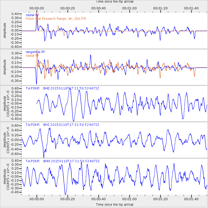
POKR Poker Plat Research Range, AK, USA - Earthquake Result Viewer
*The percent match for this event was below the threshold and hence no stack was calculated.
| Earthquake location: |
Sulu Archipelago, Philippines |
| Earthquake latitude/longitude: |
4.6/119.8 |
| Earthquake time(UTC): |
2015/01/19 (019) 17:19:45 GMT |
| Earthquake Depth: |
11 km |
| Earthquake Magnitude: |
5.5 MWB |
| Earthquake Catalog/Contributor: |
NEIC PDE/NEIC COMCAT |
|
| Network: |
TA USArray Transportable Network (new EarthScope stations) |
| Station: |
POKR Poker Plat Research Range, AK, USA |
| Lat/Lon: |
65.12 N/147.43 W |
| Elevation: |
501 m |
|
| Distance: |
87.0 deg |
| Az: |
25.034 deg |
| Baz: |
274.485 deg |
| Ray Param: |
$rayparam |
*The percent match for this event was below the threshold and hence was not used in the summary stack. |
|
| Radial Match: |
49.89482 % |
| Radial Bump: |
400 |
| Transverse Match: |
47.740177 % |
| Transverse Bump: |
400 |
| SOD ConfigId: |
837871 |
| Insert Time: |
2015-02-02 17:37:44.503 +0000 |
| GWidth: |
2.5 |
| Max Bumps: |
400 |
| Tol: |
0.001 |
|
Signal To Noise
| Channel | StoN | STA | LTA |
| TA:POKR: :BHZ:20150119T17:31:59.524973Z | 1.9914271 | 3.1661614E-7 | 1.5898958E-7 |
| TA:POKR: :BHN:20150119T17:31:59.524973Z | 0.4658687 | 9.525617E-8 | 2.0447E-7 |
| TA:POKR: :BHE:20150119T17:31:59.524973Z | 1.200322 | 2.3046368E-7 | 1.9200155E-7 |
| Arrivals |
| Ps | |
| PpPs | |
| PsPs/PpSs | |


