You are here: Home > Network List > US - United States National Seismic Network Stations List
> Station LAO LASA Array, Montana, USA > Earthquake Result Viewer
LAO LASA Array, Montana, USA - Earthquake Result Viewer
*The percent match for this event was below the threshold and hence no stack was calculated.
| Earthquake location: |
Southeast Of Honshu, Japan |
| Earthquake latitude/longitude: |
30.8/143.0 |
| Earthquake time(UTC): |
2015/05/30 (150) 18:49:07 GMT |
| Earthquake Depth: |
13 km |
| Earthquake Magnitude: |
6.4 MO |
| Earthquake Catalog/Contributor: |
NEIC PDE/NEIC ALERT |
|
| Network: |
US United States National Seismic Network |
| Station: |
LAO LASA Array, Montana, USA |
| Lat/Lon: |
46.69 N/106.22 W |
| Elevation: |
902 m |
|
| Distance: |
80.8 deg |
| Az: |
40.696 deg |
| Baz: |
305.385 deg |
| Ray Param: |
$rayparam |
*The percent match for this event was below the threshold and hence was not used in the summary stack. |
|
| Radial Match: |
59.019352 % |
| Radial Bump: |
400 |
| Transverse Match: |
53.09741 % |
| Transverse Bump: |
400 |
| SOD ConfigId: |
7422571 |
| Insert Time: |
2019-04-19 03:50:58.097 +0000 |
| GWidth: |
2.5 |
| Max Bumps: |
400 |
| Tol: |
0.001 |
|
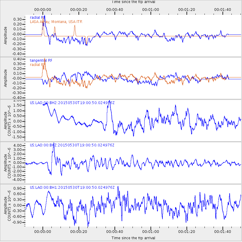
Signal To Noise
| Channel | StoN | STA | LTA |
| US:LAO:00:BHZ:20150530T19:00:50.024976Z | 7.466174 | 1.1396547E-6 | 1.5264239E-7 |
| US:LAO:00:BH1:20150530T19:00:50.024976Z | 1.8867943 | 4.5060057E-7 | 2.3881805E-7 |
| US:LAO:00:BH2:20150530T19:00:50.024976Z | 1.055218 | 6.36516E-7 | 6.032081E-7 |
| Arrivals |
| Ps | |
| PpPs | |
| PsPs/PpSs | |


