You are here: Home > Network List > IU - Global Seismograph Network (GSN - IRIS/USGS) Stations List
> Station GNI Garni, Armenia > Earthquake Result Viewer
GNI Garni, Armenia - Earthquake Result Viewer
*The percent match for this event was below the threshold and hence no stack was calculated.
| Earthquake location: |
Southern Mid-Atlantic Ridge |
| Earthquake latitude/longitude: |
-31.2/-13.3 |
| Earthquake time(UTC): |
2008/12/20 (355) 21:05:16 GMT |
| Earthquake Depth: |
4.0 km |
| Earthquake Magnitude: |
5.8 MB, 5.6 MS, 5.8 MW, 5.8 MW |
| Earthquake Catalog/Contributor: |
WHDF/NEIC |
|
| Network: |
IU Global Seismograph Network (GSN - IRIS/USGS) |
| Station: |
GNI Garni, Armenia |
| Lat/Lon: |
40.15 N/44.74 E |
| Elevation: |
1609 m |
|
| Distance: |
89.1 deg |
| Az: |
40.593 deg |
| Baz: |
226.675 deg |
| Ray Param: |
$rayparam |
*The percent match for this event was below the threshold and hence was not used in the summary stack. |
|
| Radial Match: |
60.193188 % |
| Radial Bump: |
400 |
| Transverse Match: |
50.42557 % |
| Transverse Bump: |
400 |
| SOD ConfigId: |
2658 |
| Insert Time: |
2010-03-03 13:55:42.070 +0000 |
| GWidth: |
2.5 |
| Max Bumps: |
400 |
| Tol: |
0.001 |
|
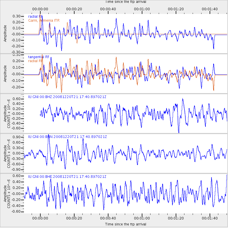
Signal To Noise
| Channel | StoN | STA | LTA |
| IU:GNI:00:BHN:20081220T21:17:40.897021Z | 3.0139265 | 3.3802922E-7 | 1.1215576E-7 |
| IU:GNI:00:BHE:20081220T21:17:40.897021Z | 1.1937523 | 1.9159671E-7 | 1.6049957E-7 |
| IU:GNI:00:BHZ:20081220T21:17:40.897021Z | 1.5206044 | 2.0906178E-7 | 1.3748597E-7 |
| Arrivals |
| Ps | |
| PpPs | |
| PsPs/PpSs | |


