You are here: Home > Network List > GS - US Geological Survey Networks Stations List
> Station DEC05 Decatur Surface Seismic Site, Decatur, IL, USA > Earthquake Result Viewer
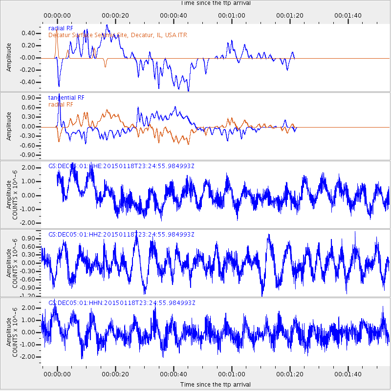
DEC05 Decatur Surface Seismic Site, Decatur, IL, USA - Earthquake Result Viewer
*The percent match for this event was below the threshold and hence no stack was calculated.
| Earthquake location: |
Southern East Pacific Rise |
| Earthquake latitude/longitude: |
-35.5/-105.8 |
| Earthquake time(UTC): |
2015/01/18 (018) 23:13:36 GMT |
| Earthquake Depth: |
8.3 km |
| Earthquake Magnitude: |
5.7 MWW, 5.5 MWB, 5.7 MWC |
| Earthquake Catalog/Contributor: |
NEIC PDE/NEIC COMCAT |
|
| Network: |
GS US Geological Survey Networks |
| Station: |
DEC05 Decatur Surface Seismic Site, Decatur, IL, USA |
| Lat/Lon: |
39.87 N/88.87 W |
| Elevation: |
216 m |
|
| Distance: |
76.6 deg |
| Az: |
13.292 deg |
| Baz: |
194.116 deg |
| Ray Param: |
$rayparam |
*The percent match for this event was below the threshold and hence was not used in the summary stack. |
|
| Radial Match: |
35.771965 % |
| Radial Bump: |
400 |
| Transverse Match: |
46.610584 % |
| Transverse Bump: |
400 |
| SOD ConfigId: |
837871 |
| Insert Time: |
2015-02-03 03:03:20.305 +0000 |
| GWidth: |
2.5 |
| Max Bumps: |
400 |
| Tol: |
0.001 |
|
Signal To Noise
| Channel | StoN | STA | LTA |
| GS:DEC05:01:HHZ:20150118T23:24:55.984993Z | 1.1424831 | 5.025537E-7 | 4.3987842E-7 |
| GS:DEC05:01:HHN:20150118T23:24:55.984993Z | 1.547302 | 1.4326249E-6 | 9.258858E-7 |
| GS:DEC05:01:HHE:20150118T23:24:55.984993Z | 1.2640718 | 1.0965881E-6 | 8.675046E-7 |
| Arrivals |
| Ps | |
| PpPs | |
| PsPs/PpSs | |


