You are here: Home > Network List > TA - USArray Transportable Network (new EarthScope stations) Stations List
> Station G59A Clarenceville, QC, USA > Earthquake Result Viewer
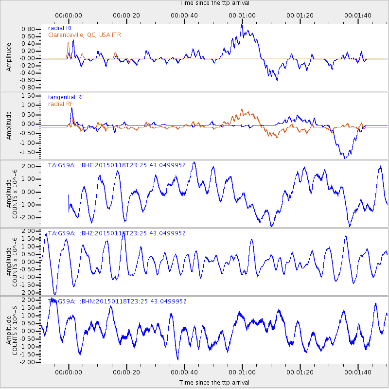
G59A Clarenceville, QC, USA - Earthquake Result Viewer
*The percent match for this event was below the threshold and hence no stack was calculated.
| Earthquake location: |
Southern East Pacific Rise |
| Earthquake latitude/longitude: |
-35.5/-105.8 |
| Earthquake time(UTC): |
2015/01/18 (018) 23:13:36 GMT |
| Earthquake Depth: |
8.3 km |
| Earthquake Magnitude: |
5.7 MWW, 5.5 MWB, 5.7 MWC |
| Earthquake Catalog/Contributor: |
NEIC PDE/NEIC COMCAT |
|
| Network: |
TA USArray Transportable Network (new EarthScope stations) |
| Station: |
G59A Clarenceville, QC, USA |
| Lat/Lon: |
45.08 N/73.18 W |
| Elevation: |
36 m |
|
| Distance: |
85.4 deg |
| Az: |
22.5 deg |
| Baz: |
206.166 deg |
| Ray Param: |
$rayparam |
*The percent match for this event was below the threshold and hence was not used in the summary stack. |
|
| Radial Match: |
16.260698 % |
| Radial Bump: |
400 |
| Transverse Match: |
40.427284 % |
| Transverse Bump: |
400 |
| SOD ConfigId: |
837871 |
| Insert Time: |
2015-02-03 03:17:14.370 +0000 |
| GWidth: |
2.5 |
| Max Bumps: |
400 |
| Tol: |
0.001 |
|
Signal To Noise
| Channel | StoN | STA | LTA |
| TA:G59A: :BHZ:20150118T23:25:43.049995Z | 1.165895 | 1.0336374E-6 | 8.865613E-7 |
| TA:G59A: :BHN:20150118T23:25:43.049995Z | 0.5677095 | 1.6757724E-6 | 2.9518133E-6 |
| TA:G59A: :BHE:20150118T23:25:43.049995Z | 0.9814186 | 1.0275356E-6 | 1.0469902E-6 |
| Arrivals |
| Ps | |
| PpPs | |
| PsPs/PpSs | |


