
ANTO Ankara, Turkey - Earthquake Result Viewer
| ||||||||||||||||||
| ||||||||||||||||||
| ||||||||||||||||||
|
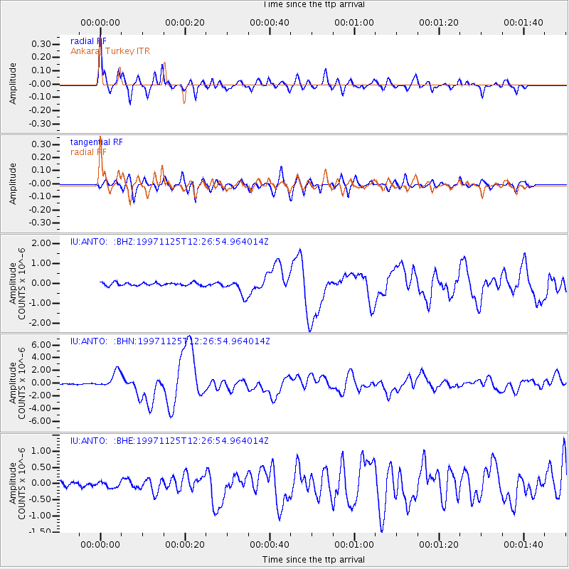
Signal To Noise
| Channel | StoN | STA | LTA |
| IU:ANTO: :BHN:19971125T12:26:54.964014Z | 20.279066 | 1.3620779E-6 | 6.7166695E-8 |
| IU:ANTO: :BHE:19971125T12:26:54.964014Z | 1.3478402 | 8.7809696E-8 | 6.514845E-8 |
| IU:ANTO: :BHZ:19971125T12:26:54.964014Z | 5.7235126 | 4.1931912E-7 | 7.326255E-8 |
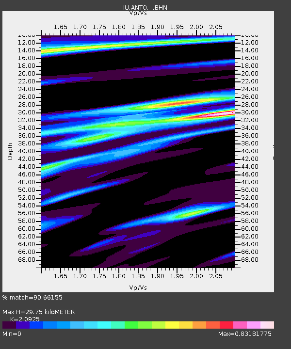
| Arrivals | |
| Ps | 5.4 SECOND |
| PpPs | 15 SECOND |
| PsPs/PpSs | 20 SECOND |

