ANTO Ankara, Turkey - Earthquake Result Viewer
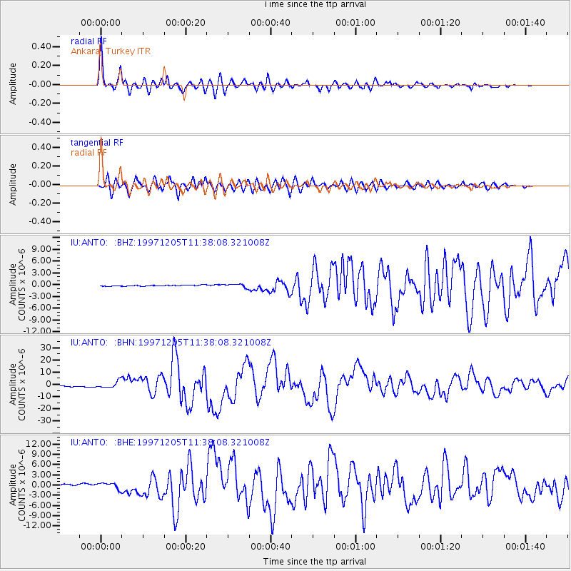
Earthquake location: Near East Coast Of Kamchatka
Earthquake latitude/longitude: 54.8/162.0
Earthquake time(UTC): 1997/12/05 (339) 11:26:54 GMT
Earthquake Depth: 33 km
Earthquake Magnitude: 6.3 MB, 7.6 MS, 7.9 UNKNOWN, 7.3 ME
Earthquake Catalog/Contributor: WHDF/NEIC
Network: IU Global Seismograph Network (GSN - IRIS/USGS)
Station: ANTO Ankara, Turkey
Lat/Lon: 39.87 N/32.79 E
Elevation: 883 m
Distance: 76.2 deg
Az: 322.129 deg
Baz: 27.477 deg
Ray Param: 0.051134773
Estimated Moho Depth: 31.75 km
Estimated Crust Vp/Vs: 1.90
Assumed Crust Vp: 6.159 km/s
Estimated Crust Vs: 3.233 km/s
Estimated Crust Poisson's Ratio: 0.31
Radial Match: 96.31303 %
Radial Bump: 400
Transverse Match: 93.32852 %
Transverse Bump: 400
SOD ConfigId: 4480
Insert Time: 2010-03-03 13:58:34.710 +0000
GWidth: 2.5
Max Bumps: 400
Tol: 0.001

Signal To Noise

ChannelStoNSTALTA
IU:ANTO: :BHN:19971205T11:38:08.321008Z6.2389242.9010139E-64.6498627E-7
IU:ANTO: :BHE:19971205T11:38:08.321008Z4.3195649.2275866E-72.1362311E-7
IU:ANTO: :BHZ:19971205T11:38:08.321008Z3.4467894.4518092E-71.2915815E-7
Arrivals
Ps4.8 SECOND
PpPs15 SECOND
PsPs/PpSs19 SECOND