You are here: Home > Network List > TA - USArray Transportable Network (new EarthScope stations) Stations List
> Station O48A Farmland, IN, USA > Earthquake Result Viewer
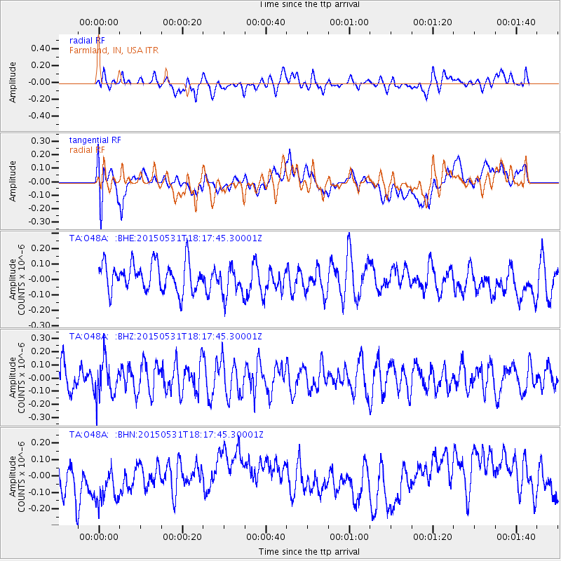
O48A Farmland, IN, USA - Earthquake Result Viewer
*The percent match for this event was below the threshold and hence no stack was calculated.
| Earthquake location: |
Rat Islands, Aleutian Islands |
| Earthquake latitude/longitude: |
51.2/178.3 |
| Earthquake time(UTC): |
2015/05/31 (151) 18:07:49 GMT |
| Earthquake Depth: |
36 km |
| Earthquake Magnitude: |
5.0 MW, 5.1 mb, 4.0 MS |
| Earthquake Catalog/Contributor: |
ISC/ISC |
|
| Network: |
TA USArray Transportable Network (new EarthScope stations) |
| Station: |
O48A Farmland, IN, USA |
| Lat/Lon: |
40.26 N/85.16 W |
| Elevation: |
300 m |
|
| Distance: |
63.6 deg |
| Az: |
58.106 deg |
| Baz: |
315.708 deg |
| Ray Param: |
$rayparam |
*The percent match for this event was below the threshold and hence was not used in the summary stack. |
|
| Radial Match: |
44.52484 % |
| Radial Bump: |
400 |
| Transverse Match: |
30.497366 % |
| Transverse Bump: |
400 |
| SOD ConfigId: |
7422571 |
| Insert Time: |
2019-04-19 04:11:15.718 +0000 |
| GWidth: |
2.5 |
| Max Bumps: |
400 |
| Tol: |
0.001 |
|
Signal To Noise
| Channel | StoN | STA | LTA |
| TA:O48A: :BHZ:20150531T18:17:45.30001Z | 1.2965968 | 1.3718116E-7 | 1.0580095E-7 |
| TA:O48A: :BHN:20150531T18:17:45.30001Z | 1.4100398 | 1.6949443E-7 | 1.2020543E-7 |
| TA:O48A: :BHE:20150531T18:17:45.30001Z | 1.1250905 | 1.03128734E-7 | 9.166261E-8 |
| Arrivals |
| Ps | |
| PpPs | |
| PsPs/PpSs | |


