ANTO Ankara, Turkey - Earthquake Result Viewer
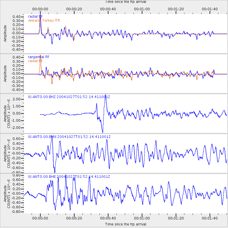
Earthquake location: Near West Coast Of Honshu, Japan
Earthquake latitude/longitude: 37.3/138.9
Earthquake time(UTC): 2004/10/27 (301) 01:40:50 GMT
Earthquake Depth: 14 km
Earthquake Magnitude: 5.7 MB, 5.4 MS, 6.0 MW, 5.9 MW
Earthquake Catalog/Contributor: WHDF/NEIC
Network: IU Global Seismograph Network (GSN - IRIS/USGS)
Station: ANTO Ankara, Turkey
Lat/Lon: 39.87 N/32.79 E
Elevation: 883 m
Distance: 77.6 deg
Az: 310.784 deg
Baz: 51.693 deg
Ray Param: 0.050214894
Estimated Moho Depth: 32.0 km
Estimated Crust Vp/Vs: 1.92
Assumed Crust Vp: 6.159 km/s
Estimated Crust Vs: 3.199 km/s
Estimated Crust Poisson's Ratio: 0.32
Radial Match: 90.57095 %
Radial Bump: 400
Transverse Match: 86.982 %
Transverse Bump: 400
SOD ConfigId: 2459
Insert Time: 2010-03-03 13:59:39.277 +0000
GWidth: 2.5
Max Bumps: 400
Tol: 0.001

Signal To Noise

ChannelStoNSTALTA
IU:ANTO:00:BHN:20041027T01:52:14.411001Z2.68424921.3748271E-75.1218315E-8
IU:ANTO:00:BHE:20041027T01:52:14.411001Z2.37618611.5549215E-76.5437696E-8
IU:ANTO:00:BHZ:20041027T01:52:14.411001Z4.7129035.049142E-71.0713445E-7
Arrivals
Ps4.9 SECOND
PpPs15 SECOND
PsPs/PpSs20 SECOND