You are here: Home > Network List > GS - US Geological Survey Networks Stations List
> Station DEC09 Decatur Surface Seismic Site, Decatur, IL, USA > Earthquake Result Viewer
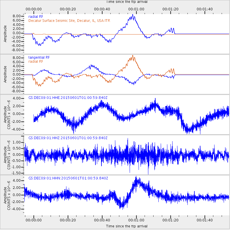
DEC09 Decatur Surface Seismic Site, Decatur, IL, USA - Earthquake Result Viewer
*The percent match for this event was below the threshold and hence no stack was calculated.
| Earthquake location: |
Kuril Islands |
| Earthquake latitude/longitude: |
44.1/146.9 |
| Earthquake time(UTC): |
2015/06/01 (152) 00:49:17 GMT |
| Earthquake Depth: |
85 km |
| Earthquake Magnitude: |
4.2 mb |
| Earthquake Catalog/Contributor: |
ISC/ISC |
|
| Network: |
GS US Geological Survey Networks |
| Station: |
DEC09 Decatur Surface Seismic Site, Decatur, IL, USA |
| Lat/Lon: |
39.87 N/88.92 W |
| Elevation: |
207 m |
|
| Distance: |
82.5 deg |
| Az: |
39.978 deg |
| Baz: |
322.991 deg |
| Ray Param: |
$rayparam |
*The percent match for this event was below the threshold and hence was not used in the summary stack. |
|
| Radial Match: |
38.000538 % |
| Radial Bump: |
400 |
| Transverse Match: |
51.118294 % |
| Transverse Bump: |
400 |
| SOD ConfigId: |
7422571 |
| Insert Time: |
2019-04-19 04:16:34.283 +0000 |
| GWidth: |
2.5 |
| Max Bumps: |
400 |
| Tol: |
0.001 |
|
Signal To Noise
| Channel | StoN | STA | LTA |
| GS:DEC09:01:HHZ:20150601T01:00:59.840Z | 0.84184325 | 2.6539465E-7 | 3.1525425E-7 |
| GS:DEC09:01:HHN:20150601T01:00:59.840Z | 0.5228157 | 5.870191E-7 | 1.1228032E-6 |
| GS:DEC09:01:HHE:20150601T01:00:59.840Z | 0.7714002 | 1.1092461E-6 | 1.4379644E-6 |
| Arrivals |
| Ps | |
| PpPs | |
| PsPs/PpSs | |


