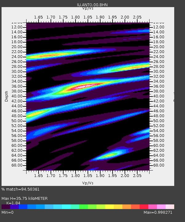
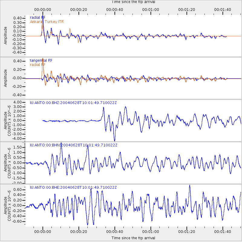
ANTO Ankara, Turkey - Earthquake Result Viewer

Earthquake location: Queen Charlotte Islands Region
Earthquake latitude/longitude: 54.8/-134.2
Earthquake time(UTC): 2004/06/28 (180) 09:49:47 GMT
Earthquake Depth: 20 km
Earthquake Magnitude: 5.9 MB, 6.8 MS, 6.8 MW, 6.8 MW
Earthquake Catalog/Contributor: WHDF/NEIC
Network: IU Global Seismograph Network (GSN - IRIS/USGS)
Station: ANTO Ankara, Turkey
Lat/Lon: 39.87 N/32.79 E
Elevation: 883 m
Distance: 85.0 deg
Az: 9.974 deg
Baz: 352.513 deg
Ray Param: 0.045025844
Estimated Moho Depth: 35.75 km
Estimated Crust Vp/Vs: 1.84
Assumed Crust Vp: 6.159 km/s
Estimated Crust Vs: 3.347 km/s
Estimated Crust Poisson's Ratio: 0.29
Radial Match: 94.58361 %
Radial Bump: 317
Transverse Match: 86.06282 %
Transverse Bump: 400
SOD ConfigId: 2459
Insert Time: 2010-03-03 14:00:11.445 +0000
GWidth: 2.5
Max Bumps: 400
Tol: 0.001

Signal To Noise

ChannelStoNSTALTA
IU:ANTO:00:BHN:20040628T10:01:49.710022Z8.2152334.072019E-74.956669E-8
IU:ANTO:00:BHE:20040628T10:01:49.710022Z2.28719071.2358475E-75.4033432E-8
IU:ANTO:00:BHZ:20040628T10:01:49.710022Z14.5287761.0357916E-67.129241E-8
Arrivals
Ps5.0 SECOND
PpPs16 SECOND
PsPs/PpSs21 SECOND