You are here: Home > Network List > UW - Pacific Northwest Regional Seismic Network Stations List
> Station MRBL Marblemount, WA, USA > Earthquake Result Viewer
MRBL Marblemount, WA, USA - Earthquake Result Viewer
*The percent match for this event was below the threshold and hence no stack was calculated.
| Earthquake location: |
Kuril Islands |
| Earthquake latitude/longitude: |
44.1/146.9 |
| Earthquake time(UTC): |
2015/06/01 (152) 00:49:17 GMT |
| Earthquake Depth: |
85 km |
| Earthquake Magnitude: |
4.2 mb |
| Earthquake Catalog/Contributor: |
ISC/ISC |
|
| Network: |
UW Pacific Northwest Regional Seismic Network |
| Station: |
MRBL Marblemount, WA, USA |
| Lat/Lon: |
48.52 N/121.48 W |
| Elevation: |
75 m |
|
| Distance: |
59.7 deg |
| Az: |
50.328 deg |
| Baz: |
303.419 deg |
| Ray Param: |
$rayparam |
*The percent match for this event was below the threshold and hence was not used in the summary stack. |
|
| Radial Match: |
24.653872 % |
| Radial Bump: |
400 |
| Transverse Match: |
24.549555 % |
| Transverse Bump: |
400 |
| SOD ConfigId: |
7422571 |
| Insert Time: |
2019-04-19 04:20:59.373 +0000 |
| GWidth: |
2.5 |
| Max Bumps: |
400 |
| Tol: |
0.001 |
|
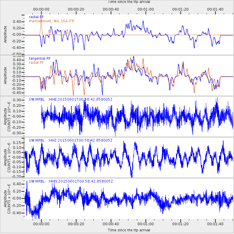
Signal To Noise
| Channel | StoN | STA | LTA |
| UW:MRBL: :HHZ:20150601T00:58:42.858005Z | 1.1306738 | 5.9517223E-8 | 5.2638725E-8 |
| UW:MRBL: :HHN:20150601T00:58:42.858005Z | 0.76817375 | 1.1468251E-7 | 1.492924E-7 |
| UW:MRBL: :HHE:20150601T00:58:42.858005Z | 0.9321694 | 9.196591E-8 | 9.8657935E-8 |
| Arrivals |
| Ps | |
| PpPs | |
| PsPs/PpSs | |


