You are here: Home > Network List > TA - USArray Transportable Network (new EarthScope stations) Stations List
> Station G59A Clarenceville, QC, USA > Earthquake Result Viewer
G59A Clarenceville, QC, USA - Earthquake Result Viewer
*The percent match for this event was below the threshold and hence no stack was calculated.
| Earthquake location: |
Off Coast Of Oregon |
| Earthquake latitude/longitude: |
44.4/-129.8 |
| Earthquake time(UTC): |
2015/06/01 (152) 06:52:41 GMT |
| Earthquake Depth: |
10 km |
| Earthquake Magnitude: |
5.8 MWP, 5.8 MI |
| Earthquake Catalog/Contributor: |
NEIC PDE/NEIC COMCAT |
|
| Network: |
TA USArray Transportable Network (new EarthScope stations) |
| Station: |
G59A Clarenceville, QC, USA |
| Lat/Lon: |
45.08 N/73.18 W |
| Elevation: |
36 m |
|
| Distance: |
39.5 deg |
| Az: |
68.465 deg |
| Baz: |
289.852 deg |
| Ray Param: |
$rayparam |
*The percent match for this event was below the threshold and hence was not used in the summary stack. |
|
| Radial Match: |
39.29246 % |
| Radial Bump: |
400 |
| Transverse Match: |
57.778316 % |
| Transverse Bump: |
266 |
| SOD ConfigId: |
7422571 |
| Insert Time: |
2019-04-19 04:26:48.052 +0000 |
| GWidth: |
2.5 |
| Max Bumps: |
400 |
| Tol: |
0.001 |
|
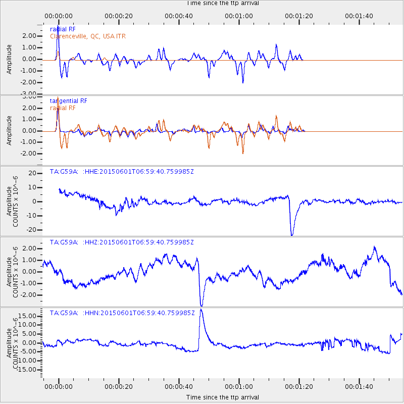
Signal To Noise
| Channel | StoN | STA | LTA |
| TA:G59A: :HHZ:20150601T06:59:40.759985Z | 0.80420744 | 6.997241E-7 | 8.700791E-7 |
| TA:G59A: :HHN:20150601T06:59:40.759985Z | 0.8990209 | 3.246778E-6 | 3.6114598E-6 |
| TA:G59A: :HHE:20150601T06:59:40.759985Z | 0.41988203 | 1.8389203E-6 | 4.379612E-6 |
| Arrivals |
| Ps | |
| PpPs | |
| PsPs/PpSs | |


