
ANTO Ankara, Turkey - Earthquake Result Viewer
| ||||||||||||||||||
| ||||||||||||||||||
| ||||||||||||||||||
|
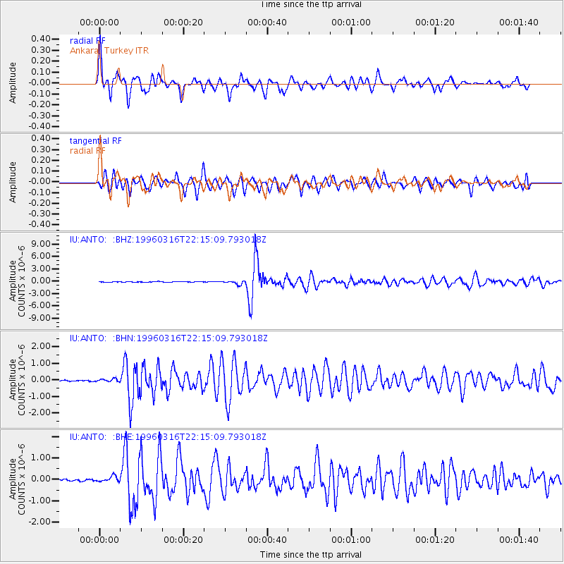
Signal To Noise
| Channel | StoN | STA | LTA |
| IU:ANTO: :BHN:19960316T22:15:09.793018Z | 2.4923997 | 8.738866E-8 | 3.5062055E-8 |
| IU:ANTO: :BHE:19960316T22:15:09.793018Z | 4.225932 | 1.3311066E-7 | 3.1498534E-8 |
| IU:ANTO: :BHZ:19960316T22:15:09.793018Z | 7.741481 | 4.45347E-7 | 5.752737E-8 |
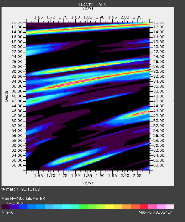
| Arrivals | |
| Ps | 8.3 SECOND |
| PpPs | 23 SECOND |
| PsPs/PpSs | 31 SECOND |

