
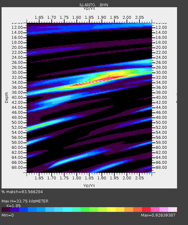
ANTO Ankara, Turkey - Earthquake Result Viewer
| ||||||||||||||||||
| ||||||||||||||||||
| ||||||||||||||||||
|
Signal To Noise
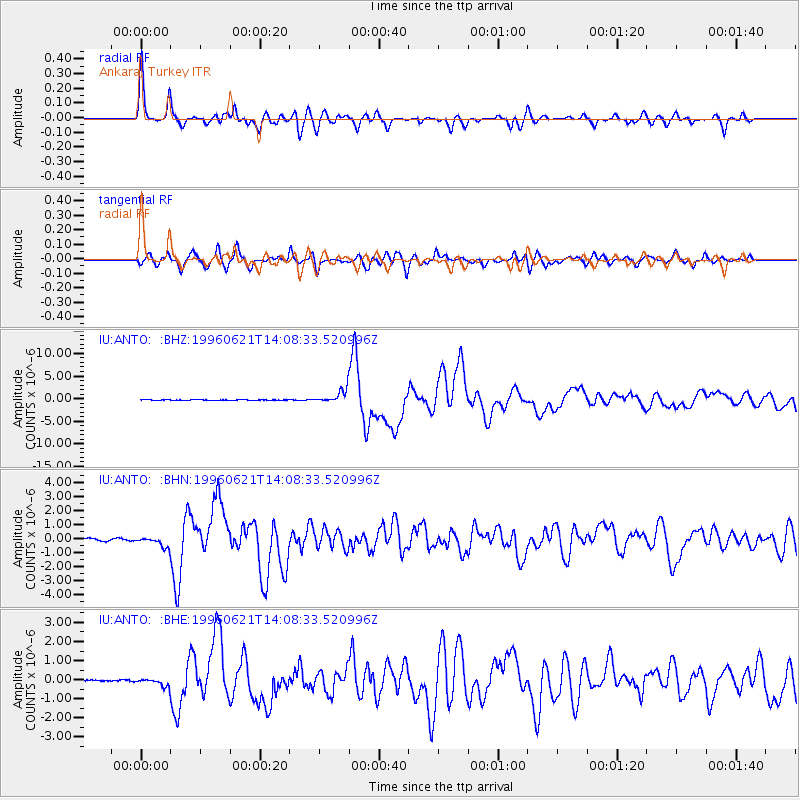
| Channel | StoN | STA | LTA |
| IU:ANTO: :BHN:19960621T14:08:33.520996Z | 5.4082503 | 3.7247466E-7 | 6.8871564E-8 |
| IU:ANTO: :BHE:19960621T14:08:33.520996Z | 5.5018663 | 2.1696538E-7 | 3.9434866E-8 |
| IU:ANTO: :BHZ:19960621T14:08:33.520996Z | 24.239058 | 1.4579094E-6 | 6.014712E-8 |
| Arrivals | |
| Ps | 4.8 SECOND |
| PpPs | 15 SECOND |
| PsPs/PpSs | 20 SECOND |

