
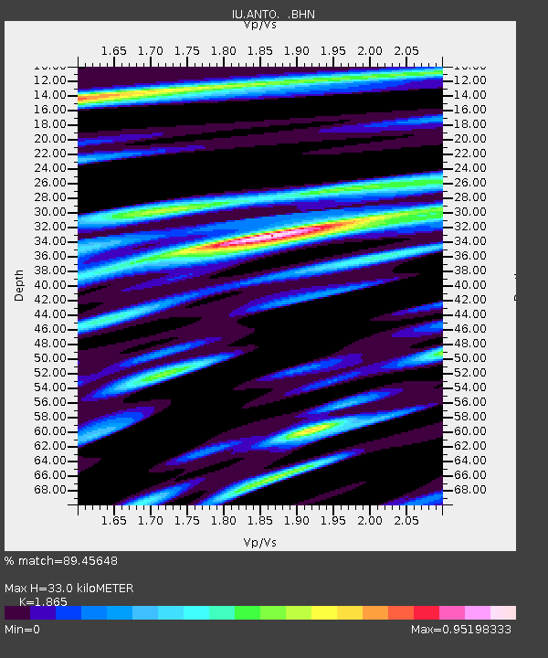
ANTO Ankara, Turkey - Earthquake Result Viewer
| ||||||||||||||||||
| ||||||||||||||||||
| ||||||||||||||||||
|
Signal To Noise
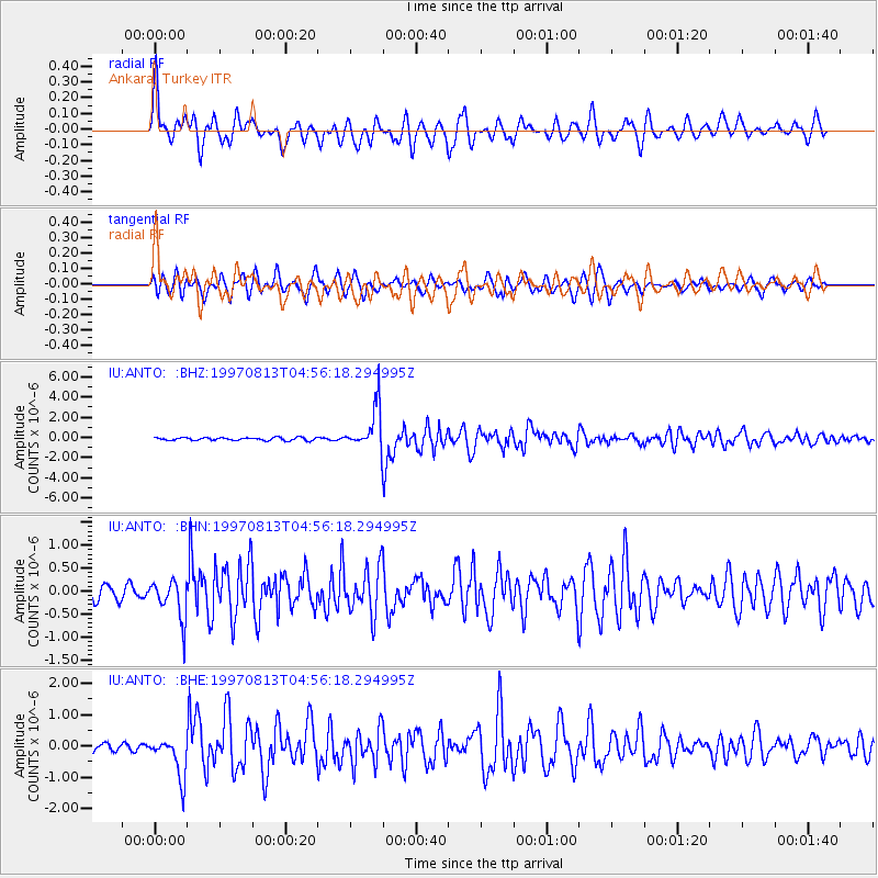
| Channel | StoN | STA | LTA |
| IU:ANTO: :BHN:19970813T04:56:18.294995Z | 2.8642838 | 4.3093237E-7 | 1.504503E-7 |
| IU:ANTO: :BHE:19970813T04:56:18.294995Z | 6.8123565 | 6.459225E-7 | 9.4816315E-8 |
| IU:ANTO: :BHZ:19970813T04:56:18.294995Z | 14.944 | 2.1155226E-6 | 1.4156335E-7 |
| Arrivals | |
| Ps | 4.8 SECOND |
| PpPs | 15 SECOND |
| PsPs/PpSs | 20 SECOND |

