You are here: Home > Network List > TA - USArray Transportable Network (new EarthScope stations) Stations List
> Station C06D Leavenworth, WQ, USA > Earthquake Result Viewer
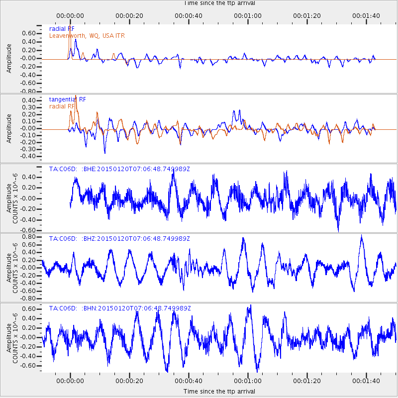
C06D Leavenworth, WQ, USA - Earthquake Result Viewer
*The percent match for this event was below the threshold and hence no stack was calculated.
| Earthquake location: |
Mexico-Guatemala Border Region |
| Earthquake latitude/longitude: |
15.0/-91.3 |
| Earthquake time(UTC): |
2015/01/20 (020) 06:59:52 GMT |
| Earthquake Depth: |
162 km |
| Earthquake Magnitude: |
5.6 MB |
| Earthquake Catalog/Contributor: |
NEIC PDE/NEIC COMCAT |
|
| Network: |
TA USArray Transportable Network (new EarthScope stations) |
| Station: |
C06D Leavenworth, WQ, USA |
| Lat/Lon: |
47.92 N/120.89 W |
| Elevation: |
544 m |
|
| Distance: |
40.9 deg |
| Az: |
329.548 deg |
| Baz: |
133.274 deg |
| Ray Param: |
$rayparam |
*The percent match for this event was below the threshold and hence was not used in the summary stack. |
|
| Radial Match: |
67.48185 % |
| Radial Bump: |
400 |
| Transverse Match: |
47.09161 % |
| Transverse Bump: |
400 |
| SOD ConfigId: |
837871 |
| Insert Time: |
2015-02-03 07:34:12.656 +0000 |
| GWidth: |
2.5 |
| Max Bumps: |
400 |
| Tol: |
0.001 |
|
Signal To Noise
| Channel | StoN | STA | LTA |
| TA:C06D: :BHZ:20150120T07:06:48.749989Z | 1.1266291 | 2.054323E-7 | 1.8234243E-7 |
| TA:C06D: :BHN:20150120T07:06:48.749989Z | 0.7795559 | 1.4842139E-7 | 1.9039223E-7 |
| TA:C06D: :BHE:20150120T07:06:48.749989Z | 1.5101053 | 2.2433507E-7 | 1.4855591E-7 |
| Arrivals |
| Ps | |
| PpPs | |
| PsPs/PpSs | |


