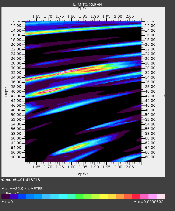
ANTO Ankara, Turkey - Earthquake Result Viewer
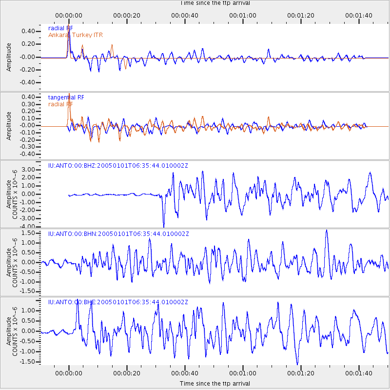
Earthquake location: Off W Coast Of Northern Sumatra
Earthquake latitude/longitude: 5.1/92.3
Earthquake time(UTC): 2005/01/01 (001) 06:25:44 GMT
Earthquake Depth: 12 km
Earthquake Magnitude: 6.0 MB, 6.7 MS, 6.6 MW, 6.5 MW
Earthquake Catalog/Contributor: WHDF/NEIC
Network: IU Global Seismograph Network (GSN - IRIS/USGS)
Station: ANTO Ankara, Turkey
Lat/Lon: 39.87 N/32.79 E
Elevation: 883 m
Distance: 63.6 deg
Az: 312.208 deg
Baz: 106.53 deg
Ray Param: 0.059497654
Estimated Moho Depth: 32.0 km
Estimated Crust Vp/Vs: 1.75
Assumed Crust Vp: 6.159 km/s
Estimated Crust Vs: 3.519 km/s
Estimated Crust Poisson's Ratio: 0.26
Radial Match: 91.415215 %
Radial Bump: 400
Transverse Match: 85.51717 %
Transverse Bump: 400
SOD ConfigId: 5233
Insert Time: 2010-03-03 14:04:48.561 +0000
GWidth: 2.5
Max Bumps: 400
Tol: 0.001

Signal To Noise

ChannelStoNSTALTA
IU:ANTO:00:BHN:20050101T06:35:44.010002Z2.70844821.9771895E-77.300082E-8
IU:ANTO:00:BHE:20050101T06:35:44.010002Z7.7804155.140494E-76.606967E-8
IU:ANTO:00:BHZ:20050101T06:35:44.010002Z16.8935871.2434401E-67.360426E-8
Arrivals
Ps4.1 SECOND
PpPs14 SECOND
PsPs/PpSs18 SECOND