
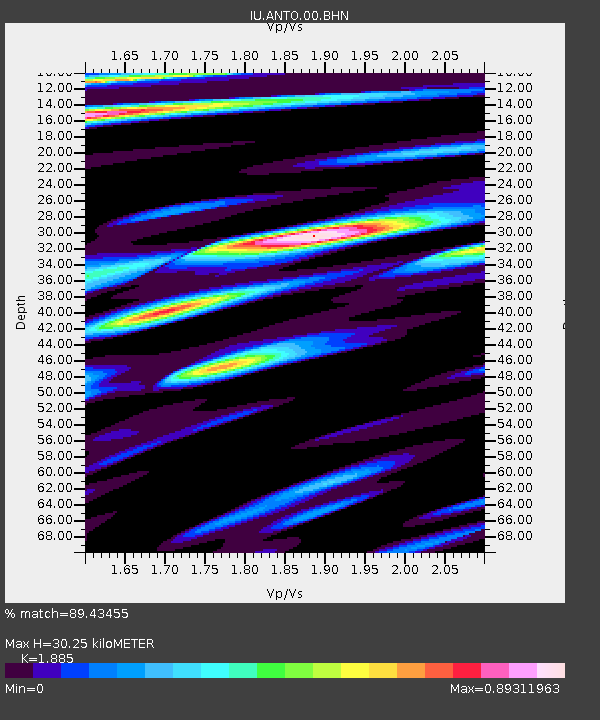
ANTO Ankara, Turkey - Earthquake Result Viewer
| ||||||||||||||||||
| ||||||||||||||||||
| ||||||||||||||||||
|
Signal To Noise
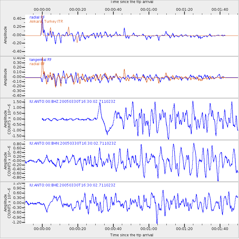
| Channel | StoN | STA | LTA |
| IU:ANTO:00:BHN:20050330T16:30:02.711023Z | 1.5902388 | 1.09727544E-7 | 6.900067E-8 |
| IU:ANTO:00:BHE:20050330T16:30:02.711023Z | 3.4613016 | 2.2260049E-7 | 6.4311216E-8 |
| IU:ANTO:00:BHZ:20050330T16:30:02.711023Z | 11.589158 | 5.998741E-7 | 5.1761663E-8 |
| Arrivals | |
| Ps | 4.5 SECOND |
| PpPs | 14 SECOND |
| PsPs/PpSs | 18 SECOND |

