ANTO Ankara, Turkey - Earthquake Result Viewer
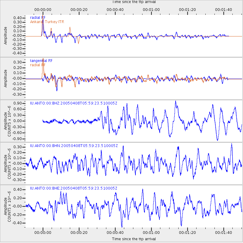
Earthquake location: Southwest Of Sumatra, Indonesia
Earthquake latitude/longitude: -0.2/97.7
Earthquake time(UTC): 2005/04/08 (098) 05:48:37 GMT
Earthquake Depth: 21 km
Earthquake Magnitude: 5.7 MB, 6.3 MS, 6.1 MW, 6.1 MW
Earthquake Catalog/Contributor: WHDF/NEIC
Network: IU Global Seismograph Network (GSN - IRIS/USGS)
Station: ANTO Ankara, Turkey
Lat/Lon: 39.87 N/32.79 E
Elevation: 883 m
Distance: 71.1 deg
Az: 312.539 deg
Baz: 106.791 deg
Ray Param: 0.054511543
Estimated Moho Depth: 14.75 km
Estimated Crust Vp/Vs: 1.60
Assumed Crust Vp: 6.159 km/s
Estimated Crust Vs: 3.849 km/s
Estimated Crust Poisson's Ratio: 0.18
Radial Match: 88.95609 %
Radial Bump: 400
Transverse Match: 67.5882 %
Transverse Bump: 400
SOD ConfigId: 2459
Insert Time: 2010-03-03 14:05:15.375 +0000
GWidth: 2.5
Max Bumps: 400
Tol: 0.001

Signal To Noise

ChannelStoNSTALTA
IU:ANTO:00:BHN:20050408T05:59:23.510005Z1.16845215.8532507E-85.0094055E-8
IU:ANTO:00:BHE:20050408T05:59:23.510005Z2.14815938.2970814E-83.8624144E-8
IU:ANTO:00:BHZ:20050408T05:59:23.510005Z4.60375832.3610436E-75.128513E-8
Arrivals
Ps1.5 SECOND
PpPs6.0 SECOND
PsPs/PpSs7.5 SECOND