
ANTO Ankara, Turkey - Earthquake Result Viewer
| ||||||||||||||||||
| ||||||||||||||||||
| ||||||||||||||||||
|
Signal To Noise
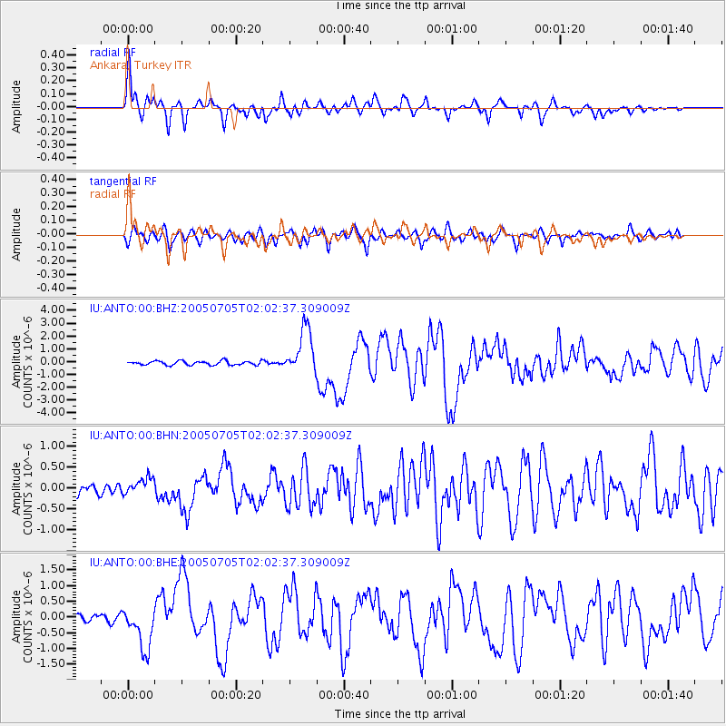
| Channel | StoN | STA | LTA |
| IU:ANTO:00:BHN:20050705T02:02:37.309009Z | 2.2458591 | 2.0902753E-7 | 9.3072416E-8 |
| IU:ANTO:00:BHE:20050705T02:02:37.309009Z | 4.969738 | 7.0399017E-7 | 1.4165539E-7 |
| IU:ANTO:00:BHZ:20050705T02:02:37.309009Z | 11.650506 | 1.8084236E-6 | 1.5522275E-7 |
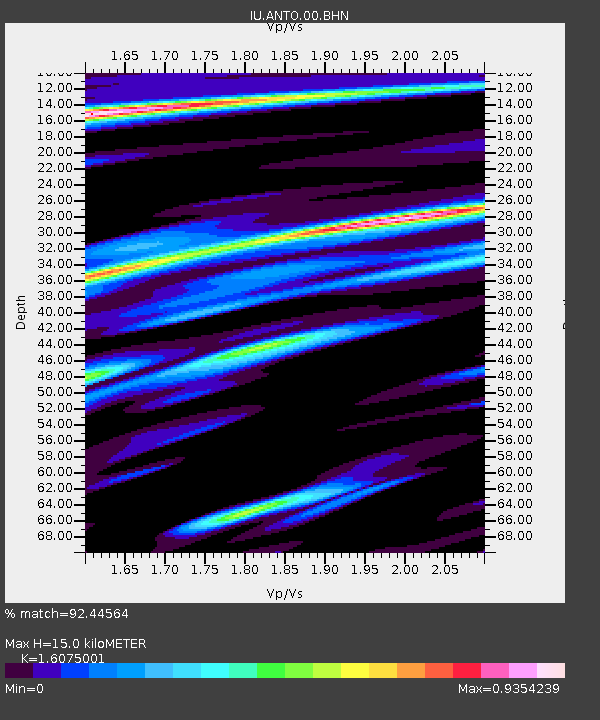
| Arrivals | |
| Ps | 1.5 SECOND |
| PpPs | 6.1 SECOND |
| PsPs/PpSs | 7.6 SECOND |

