
ANTO Ankara, Turkey - Earthquake Result Viewer
| ||||||||||||||||||
| ||||||||||||||||||
| ||||||||||||||||||
|
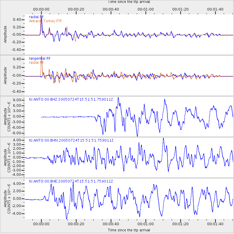
Signal To Noise
| Channel | StoN | STA | LTA |
| IU:ANTO:00:BHN:20050724T15:51:51.759011Z | 3.8816197 | 1.685938E-7 | 4.343388E-8 |
| IU:ANTO:00:BHE:20050724T15:51:51.759011Z | 11.663301 | 6.1185244E-7 | 5.245963E-8 |
| IU:ANTO:00:BHZ:20050724T15:51:51.759011Z | 21.026894 | 1.7785051E-6 | 8.45824E-8 |
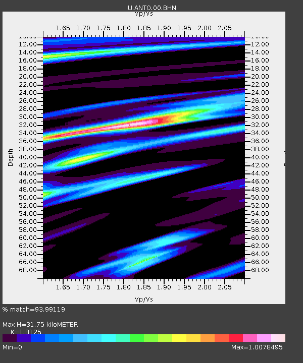
| Arrivals | |
| Ps | 4.4 SECOND |
| PpPs | 14 SECOND |
| PsPs/PpSs | 18 SECOND |

