You are here: Home > Network List > TA - USArray Transportable Network (new EarthScope stations) Stations List
> Station I61A Oroboro, Fairlee, VT, USA > Earthquake Result Viewer
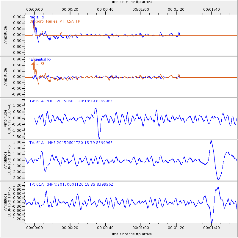
I61A Oroboro, Fairlee, VT, USA - Earthquake Result Viewer

| Earthquake location: |
Off Coast Of Oregon |
| Earthquake latitude/longitude: |
44.5/-129.9 |
| Earthquake time(UTC): |
2015/06/01 (152) 20:11:31 GMT |
| Earthquake Depth: |
10 km |
| Earthquake Magnitude: |
5.9 MO |
| Earthquake Catalog/Contributor: |
NEIC PDE/NEIC ALERT |
|
| Network: |
TA USArray Transportable Network (new EarthScope stations) |
| Station: |
I61A Oroboro, Fairlee, VT, USA |
| Lat/Lon: |
43.93 N/72.21 W |
| Elevation: |
287 m |
|
| Distance: |
40.6 deg |
| Az: |
69.776 deg |
| Baz: |
291.624 deg |
| Ray Param: |
0.074323475 |
| Estimated Moho Depth: |
42.5 km |
| Estimated Crust Vp/Vs: |
1.92 |
| Assumed Crust Vp: |
6.419 km/s |
| Estimated Crust Vs: |
3.339 km/s |
| Estimated Crust Poisson's Ratio: |
0.31 |
|
| Radial Match: |
87.428986 % |
| Radial Bump: |
400 |
| Transverse Match: |
63.871357 % |
| Transverse Bump: |
400 |
| SOD ConfigId: |
7422571 |
| Insert Time: |
2019-04-19 04:47:35.890 +0000 |
| GWidth: |
2.5 |
| Max Bumps: |
400 |
| Tol: |
0.001 |
|
Signal To Noise
| Channel | StoN | STA | LTA |
| TA:I61A: :HHZ:20150601T20:18:39.839996Z | 2.6939442 | 6.5986853E-7 | 2.4494514E-7 |
| TA:I61A: :HHN:20150601T20:18:39.839996Z | 1.1554705 | 1.8575493E-7 | 1.607613E-7 |
| TA:I61A: :HHE:20150601T20:18:39.839996Z | 1.8820302 | 4.050192E-7 | 2.1520334E-7 |
| Arrivals |
| Ps | 6.5 SECOND |
| PpPs | 18 SECOND |
| PsPs/PpSs | 25 SECOND |


