ANTO Ankara, Turkey - Earthquake Result Viewer
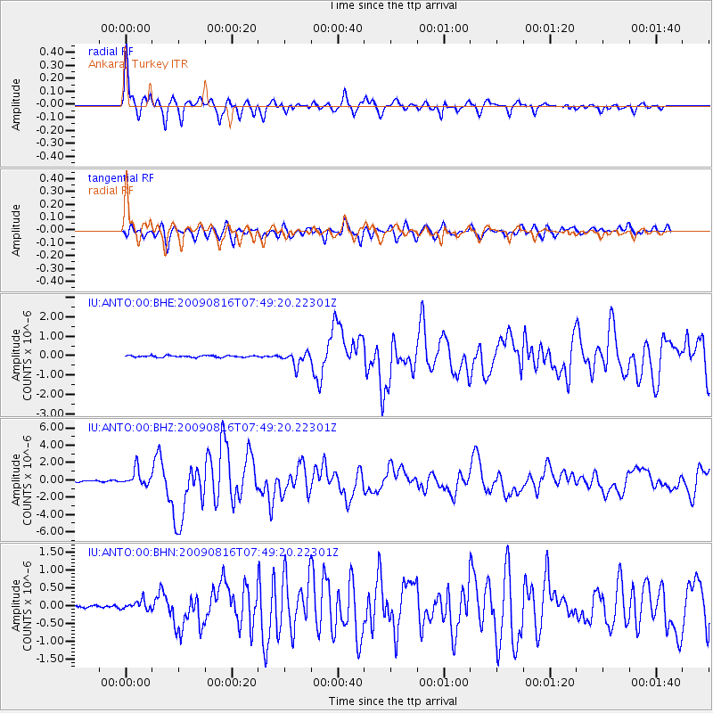
Earthquake location: Southern Sumatra, Indonesia
Earthquake latitude/longitude: -1.5/99.5
Earthquake time(UTC): 2009/08/16 (228) 07:38:21 GMT
Earthquake Depth: 20 km
Earthquake Magnitude: 6.5 MB, 6.7 MS, 6.7 MW, 6.5 MW
Earthquake Catalog/Contributor: WHDF/NEIC
Network: IU Global Seismograph Network (GSN - IRIS/USGS)
Station: ANTO Ankara, Turkey
Lat/Lon: 39.87 N/32.79 E
Elevation: 1090 m
Distance: 73.3 deg
Az: 312.428 deg
Baz: 106.516 deg
Ray Param: 0.053100977
Estimated Moho Depth: 34.25 km
Estimated Crust Vp/Vs: 1.63
Assumed Crust Vp: 6.159 km/s
Estimated Crust Vs: 3.767 km/s
Estimated Crust Poisson's Ratio: 0.20
Radial Match: 89.575645 %
Radial Bump: 400
Transverse Match: 78.84559 %
Transverse Bump: 400
SOD ConfigId: 2622
Insert Time: 2010-03-03 14:07:00.198 +0000
GWidth: 2.5
Max Bumps: 400
Tol: 0.001

Signal To Noise

ChannelStoNSTALTA
IU:ANTO:00:BHZ:20090816T07:49:20.22301Z14.7614339.520566E-76.449622E-8
IU:ANTO:00:BHN:20090816T07:49:20.22301Z2.0346661.3051945E-76.414785E-8
IU:ANTO:00:BHE:20090816T07:49:20.22301Z7.66288333.4351768E-74.4828777E-8
Arrivals
Ps3.7 SECOND
PpPs14 SECOND
PsPs/PpSs18 SECOND