You are here: Home > Network List > AV - Alaska Volcano Observatory Stations List
> Station MAPS Pakushin Southeast, Makushin Volcano, Alaska > Earthquake Result Viewer
MAPS Pakushin Southeast, Makushin Volcano, Alaska - Earthquake Result Viewer
*The percent match for this event was below the threshold and hence no stack was calculated.
| Earthquake location: |
Bonin Islands, Japan Region |
| Earthquake latitude/longitude: |
27.9/140.6 |
| Earthquake time(UTC): |
2015/06/02 (153) 21:04:28 GMT |
| Earthquake Depth: |
687 km |
| Earthquake Magnitude: |
4.9 mb |
| Earthquake Catalog/Contributor: |
ISC/ISC |
|
| Network: |
AV Alaska Volcano Observatory |
| Station: |
MAPS Pakushin Southeast, Makushin Volcano, Alaska |
| Lat/Lon: |
53.81 N/166.94 W |
| Elevation: |
333 m |
|
| Distance: |
46.0 deg |
| Az: |
40.796 deg |
| Baz: |
257.269 deg |
| Ray Param: |
$rayparam |
*The percent match for this event was below the threshold and hence was not used in the summary stack. |
|
| Radial Match: |
40.047665 % |
| Radial Bump: |
400 |
| Transverse Match: |
41.328884 % |
| Transverse Bump: |
400 |
| SOD ConfigId: |
7422571 |
| Insert Time: |
2019-04-19 04:59:01.530 +0000 |
| GWidth: |
2.5 |
| Max Bumps: |
400 |
| Tol: |
0.001 |
|
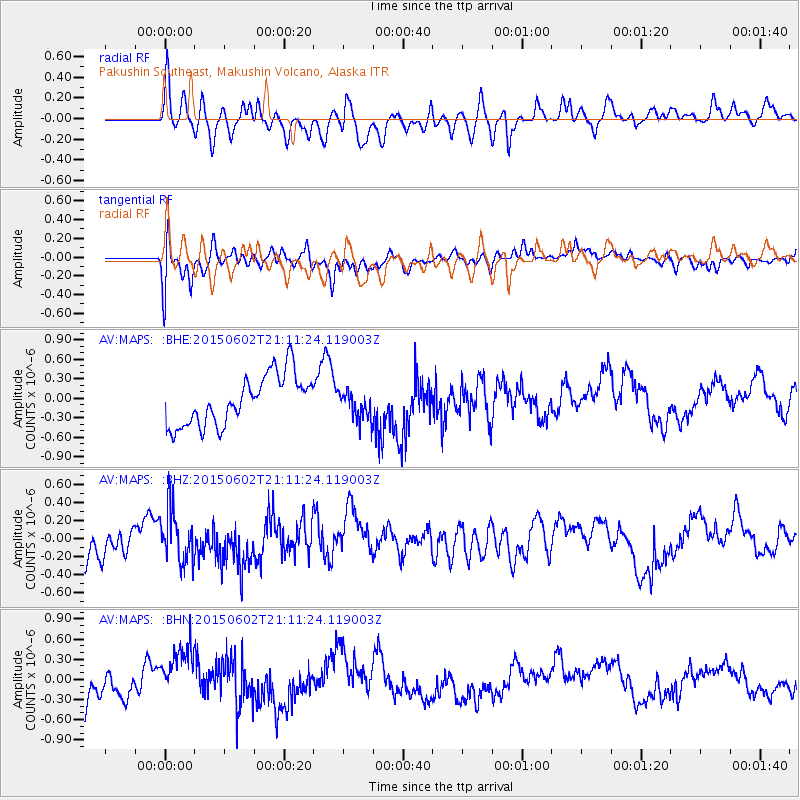
Signal To Noise
| Channel | StoN | STA | LTA |
| AV:MAPS: :BHZ:20150602T21:11:24.119003Z | 1.4314348 | 2.855037E-7 | 1.994528E-7 |
| AV:MAPS: :BHN:20150602T21:11:24.119003Z | 1.6074768 | 4.2867498E-7 | 2.6667567E-7 |
| AV:MAPS: :BHE:20150602T21:11:24.119003Z | 0.56354284 | 2.1794362E-7 | 3.8673835E-7 |
| Arrivals |
| Ps | |
| PpPs | |
| PsPs/PpSs | |


