OSI Osito Adit, California, USA - Earthquake Result Viewer
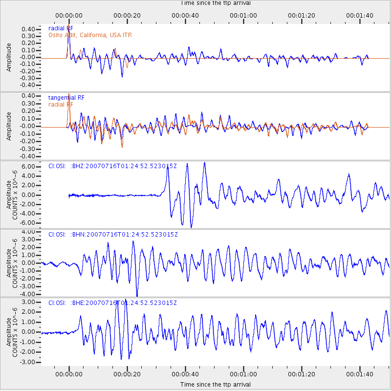
Earthquake location: Near West Coast Of Honshu, Japan
Earthquake latitude/longitude: 37.5/138.4
Earthquake time(UTC): 2007/07/16 (197) 01:13:22 GMT
Earthquake Depth: 12 km
Earthquake Magnitude: 6.5 MB, 6.4 MS, 6.6 MW, 6.5 MW
Earthquake Catalog/Contributor: WHDF/NEIC
Network: CI Caltech Regional Seismic Network
Station: OSI Osito Adit, California, USA
Lat/Lon: 34.61 N/118.72 W
Elevation: 706 m
Distance: 78.6 deg
Az: 55.118 deg
Baz: 307.752 deg
Ray Param: 0.04951946
Estimated Moho Depth: 33.25 km
Estimated Crust Vp/Vs: 1.94
Assumed Crust Vp: 6.1 km/s
Estimated Crust Vs: 3.148 km/s
Estimated Crust Poisson's Ratio: 0.32
Radial Match: 89.5197 %
Radial Bump: 400
Transverse Match: 91.48107 %
Transverse Bump: 400
SOD ConfigId: 2564
Insert Time: 2010-02-25 21:29:32.319 +0000
GWidth: 2.5
Max Bumps: 400
Tol: 0.001

Signal To Noise

ChannelStoNSTALTA
CI:OSI: :BHN:20070716T01:24:52.523015Z6.07134065.664534E-79.329956E-8
CI:OSI: :BHE:20070716T01:24:52.523015Z6.51783665.849599E-78.974755E-8
CI:OSI: :BHZ:20070716T01:24:52.523015Z23.5341032.1956296E-69.3295654E-8
Arrivals
Ps5.2 SECOND
PpPs16 SECOND
PsPs/PpSs21 SECOND