You are here: Home > Network List > CN - Canadian National Seismograph Network Stations List
> Station INK INUVIK, NT > Earthquake Result Viewer
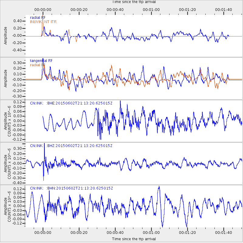
INK INUVIK, NT - Earthquake Result Viewer
*The percent match for this event was below the threshold and hence no stack was calculated.
| Earthquake location: |
Bonin Islands, Japan Region |
| Earthquake latitude/longitude: |
27.9/140.6 |
| Earthquake time(UTC): |
2015/06/02 (153) 21:04:28 GMT |
| Earthquake Depth: |
687 km |
| Earthquake Magnitude: |
4.9 mb |
| Earthquake Catalog/Contributor: |
ISC/ISC |
|
| Network: |
CN Canadian National Seismograph Network |
| Station: |
INK INUVIK, NT |
| Lat/Lon: |
68.31 N/133.53 W |
| Elevation: |
44 m |
|
| Distance: |
62.9 deg |
| Az: |
24.612 deg |
| Baz: |
277.341 deg |
| Ray Param: |
$rayparam |
*The percent match for this event was below the threshold and hence was not used in the summary stack. |
|
| Radial Match: |
46.099213 % |
| Radial Bump: |
400 |
| Transverse Match: |
45.239044 % |
| Transverse Bump: |
400 |
| SOD ConfigId: |
7422571 |
| Insert Time: |
2019-04-19 04:59:58.686 +0000 |
| GWidth: |
2.5 |
| Max Bumps: |
400 |
| Tol: |
0.001 |
|
Signal To Noise
| Channel | StoN | STA | LTA |
| CN:INK: :BHZ:20150602T21:13:20.625015Z | 2.8034592 | 1.0895369E-7 | 3.886402E-8 |
| CN:INK: :BHN:20150602T21:13:20.625015Z | 0.83707815 | 5.1145527E-8 | 6.110006E-8 |
| CN:INK: :BHE:20150602T21:13:20.625015Z | 1.7703238 | 5.8305798E-8 | 3.2935105E-8 |
| Arrivals |
| Ps | |
| PpPs | |
| PsPs/PpSs | |


