
ANTO Ankara, Turkey - Earthquake Result Viewer
| ||||||||||||||||||
| ||||||||||||||||||
| ||||||||||||||||||
|
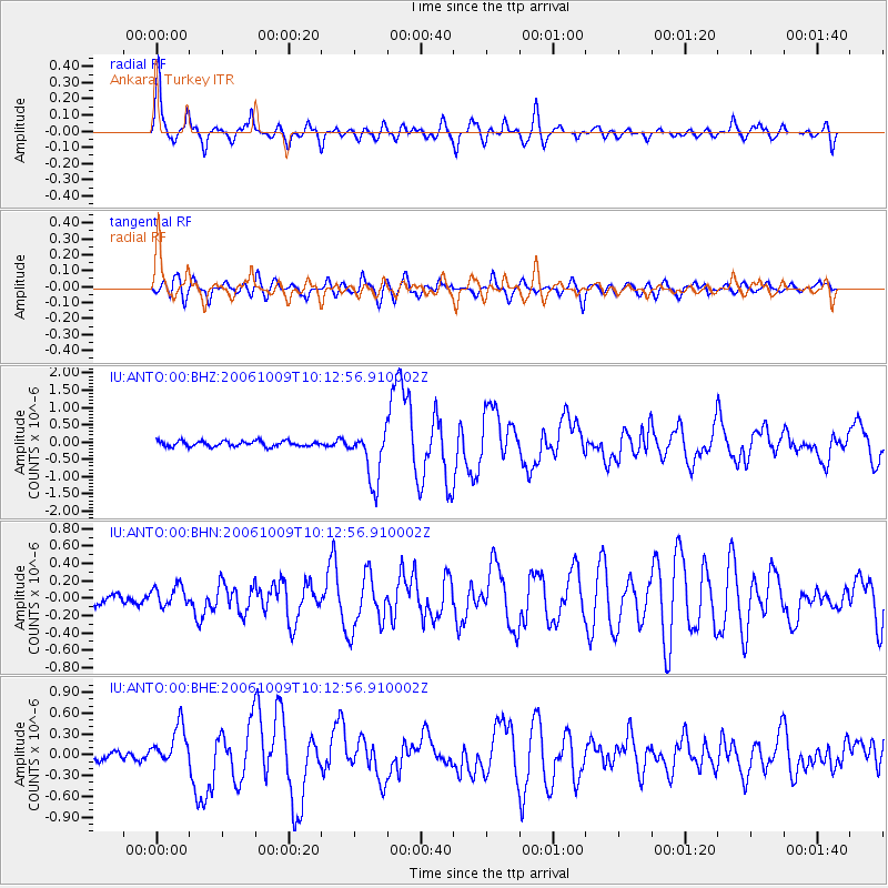
Signal To Noise
| Channel | StoN | STA | LTA |
| IU:ANTO:00:BHN:20061009T10:12:56.910002Z | 1.9590524 | 1.1599364E-7 | 5.9209054E-8 |
| IU:ANTO:00:BHE:20061009T10:12:56.910002Z | 4.6187773 | 2.8308037E-7 | 6.128903E-8 |
| IU:ANTO:00:BHZ:20061009T10:12:56.910002Z | 9.62141 | 7.565439E-7 | 7.863129E-8 |
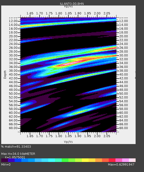
| Arrivals | |
| Ps | 4.9 SECOND |
| PpPs | 15 SECOND |
| PsPs/PpSs | 20 SECOND |

