You are here: Home > Network List > TA - USArray Transportable Network (new EarthScope stations) Stations List
> Station O03E Paynes Creek, CA, USA > Earthquake Result Viewer
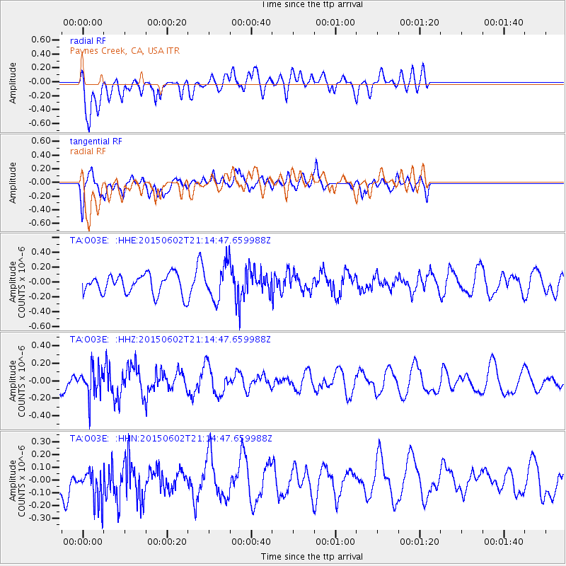
O03E Paynes Creek, CA, USA - Earthquake Result Viewer
*The percent match for this event was below the threshold and hence no stack was calculated.
| Earthquake location: |
Bonin Islands, Japan Region |
| Earthquake latitude/longitude: |
27.9/140.6 |
| Earthquake time(UTC): |
2015/06/02 (153) 21:04:28 GMT |
| Earthquake Depth: |
687 km |
| Earthquake Magnitude: |
4.9 mb |
| Earthquake Catalog/Contributor: |
ISC/ISC |
|
| Network: |
TA USArray Transportable Network (new EarthScope stations) |
| Station: |
O03E Paynes Creek, CA, USA |
| Lat/Lon: |
40.29 N/121.80 W |
| Elevation: |
967 m |
|
| Distance: |
77.9 deg |
| Az: |
50.842 deg |
| Baz: |
296.157 deg |
| Ray Param: |
$rayparam |
*The percent match for this event was below the threshold and hence was not used in the summary stack. |
|
| Radial Match: |
58.734676 % |
| Radial Bump: |
400 |
| Transverse Match: |
43.80995 % |
| Transverse Bump: |
400 |
| SOD ConfigId: |
7422571 |
| Insert Time: |
2019-04-19 05:02:55.634 +0000 |
| GWidth: |
2.5 |
| Max Bumps: |
400 |
| Tol: |
0.001 |
|
Signal To Noise
| Channel | StoN | STA | LTA |
| TA:O03E: :HHZ:20150602T21:14:47.659988Z | 1.655928 | 1.6355945E-7 | 9.877207E-8 |
| TA:O03E: :HHN:20150602T21:14:47.659988Z | 1.2961731 | 1.5276537E-7 | 1.1785877E-7 |
| TA:O03E: :HHE:20150602T21:14:47.659988Z | 1.7841586 | 2.3287042E-7 | 1.3052114E-7 |
| Arrivals |
| Ps | |
| PpPs | |
| PsPs/PpSs | |


