You are here: Home > Network List > UW - Pacific Northwest Regional Seismic Network Stations List
> Station LEBA Lebam, WA, USA > Earthquake Result Viewer
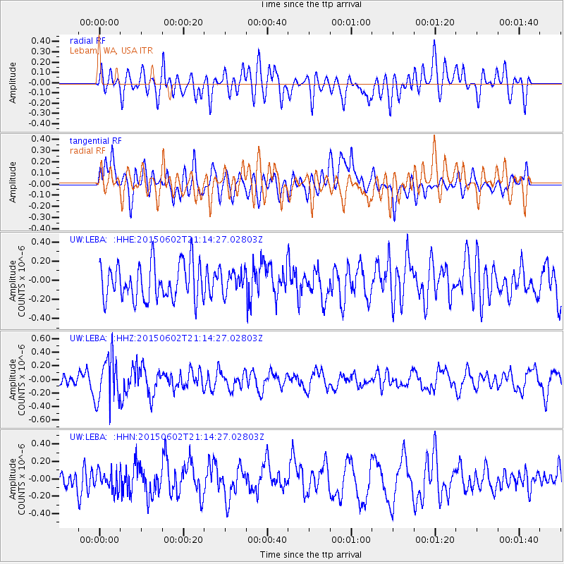
LEBA Lebam, WA, USA - Earthquake Result Viewer
*The percent match for this event was below the threshold and hence no stack was calculated.
| Earthquake location: |
Bonin Islands, Japan Region |
| Earthquake latitude/longitude: |
27.9/140.6 |
| Earthquake time(UTC): |
2015/06/02 (153) 21:04:28 GMT |
| Earthquake Depth: |
687 km |
| Earthquake Magnitude: |
4.9 mb |
| Earthquake Catalog/Contributor: |
ISC/ISC |
|
| Network: |
UW Pacific Northwest Regional Seismic Network |
| Station: |
LEBA Lebam, WA, USA |
| Lat/Lon: |
46.55 N/123.56 W |
| Elevation: |
73 m |
|
| Distance: |
74.1 deg |
| Az: |
45.559 deg |
| Baz: |
293.668 deg |
| Ray Param: |
$rayparam |
*The percent match for this event was below the threshold and hence was not used in the summary stack. |
|
| Radial Match: |
62.270065 % |
| Radial Bump: |
400 |
| Transverse Match: |
61.37528 % |
| Transverse Bump: |
400 |
| SOD ConfigId: |
7422571 |
| Insert Time: |
2019-04-19 05:03:47.969 +0000 |
| GWidth: |
2.5 |
| Max Bumps: |
400 |
| Tol: |
0.001 |
|
Signal To Noise
| Channel | StoN | STA | LTA |
| UW:LEBA: :HHZ:20150602T21:14:27.02803Z | 3.0112298 | 3.3903967E-7 | 1.1259176E-7 |
| UW:LEBA: :HHN:20150602T21:14:27.02803Z | 0.8708887 | 1.0891435E-7 | 1.2506115E-7 |
| UW:LEBA: :HHE:20150602T21:14:27.02803Z | 0.5802138 | 1.0969115E-7 | 1.8905298E-7 |
| Arrivals |
| Ps | |
| PpPs | |
| PsPs/PpSs | |


