You are here: Home > Network List > AV - Alaska Volcano Observatory Stations List
> Station MAPS Pakushin Southeast, Makushin Volcano, Alaska > Earthquake Result Viewer
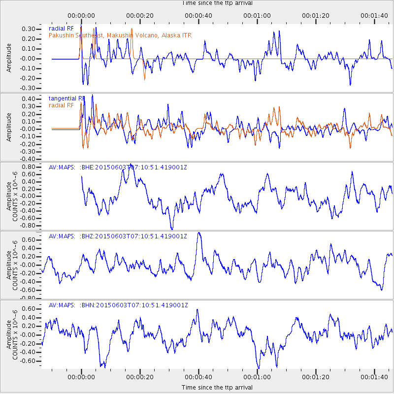
MAPS Pakushin Southeast, Makushin Volcano, Alaska - Earthquake Result Viewer
*The percent match for this event was below the threshold and hence no stack was calculated.
| Earthquake location: |
Fiji Islands Region |
| Earthquake latitude/longitude: |
-19.7/-179.0 |
| Earthquake time(UTC): |
2015/06/03 (154) 07:00:52 GMT |
| Earthquake Depth: |
669 km |
| Earthquake Magnitude: |
5.5 MW |
| Earthquake Catalog/Contributor: |
ISC/ISC |
|
| Network: |
AV Alaska Volcano Observatory |
| Station: |
MAPS Pakushin Southeast, Makushin Volcano, Alaska |
| Lat/Lon: |
53.81 N/166.94 W |
| Elevation: |
333 m |
|
| Distance: |
74.0 deg |
| Az: |
7.434 deg |
| Baz: |
191.86 deg |
| Ray Param: |
$rayparam |
*The percent match for this event was below the threshold and hence was not used in the summary stack. |
|
| Radial Match: |
47.941055 % |
| Radial Bump: |
400 |
| Transverse Match: |
42.159496 % |
| Transverse Bump: |
400 |
| SOD ConfigId: |
7422571 |
| Insert Time: |
2019-04-19 05:05:59.940 +0000 |
| GWidth: |
2.5 |
| Max Bumps: |
400 |
| Tol: |
0.001 |
|
Signal To Noise
| Channel | StoN | STA | LTA |
| AV:MAPS: :BHZ:20150603T07:10:51.419001Z | 0.61608654 | 1.2647057E-7 | 2.0528054E-7 |
| AV:MAPS: :BHN:20150603T07:10:51.419001Z | 0.9965509 | 1.8590173E-7 | 1.8654514E-7 |
| AV:MAPS: :BHE:20150603T07:10:51.419001Z | 1.6737292 | 5.9643423E-7 | 3.5635048E-7 |
| Arrivals |
| Ps | |
| PpPs | |
| PsPs/PpSs | |


