You are here: Home > Network List > CN - Canadian National Seismograph Network Stations List
> Station INK INUVIK, NT > Earthquake Result Viewer
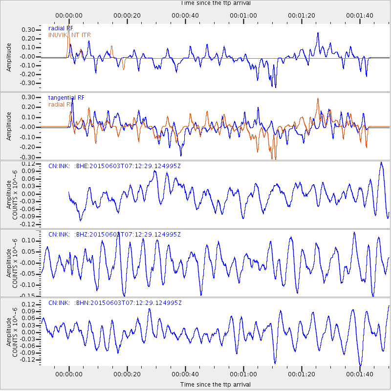
INK INUVIK, NT - Earthquake Result Viewer
*The percent match for this event was below the threshold and hence no stack was calculated.
| Earthquake location: |
Fiji Islands Region |
| Earthquake latitude/longitude: |
-19.7/-179.0 |
| Earthquake time(UTC): |
2015/06/03 (154) 07:00:52 GMT |
| Earthquake Depth: |
669 km |
| Earthquake Magnitude: |
5.5 MW |
| Earthquake Catalog/Contributor: |
ISC/ISC |
|
| Network: |
CN Canadian National Seismograph Network |
| Station: |
INK INUVIK, NT |
| Lat/Lon: |
68.31 N/133.53 W |
| Elevation: |
44 m |
|
| Distance: |
93.8 deg |
| Az: |
15.417 deg |
| Baz: |
222.347 deg |
| Ray Param: |
$rayparam |
*The percent match for this event was below the threshold and hence was not used in the summary stack. |
|
| Radial Match: |
47.72025 % |
| Radial Bump: |
400 |
| Transverse Match: |
56.567986 % |
| Transverse Bump: |
400 |
| SOD ConfigId: |
7422571 |
| Insert Time: |
2019-04-19 05:07:05.744 +0000 |
| GWidth: |
2.5 |
| Max Bumps: |
400 |
| Tol: |
0.001 |
|
Signal To Noise
| Channel | StoN | STA | LTA |
| CN:INK: :BHZ:20150603T07:12:29.124995Z | 1.0825417 | 3.372976E-8 | 3.1157928E-8 |
| CN:INK: :BHN:20150603T07:12:29.124995Z | 0.5386274 | 2.2274849E-8 | 4.1354838E-8 |
| CN:INK: :BHE:20150603T07:12:29.124995Z | 2.3338153 | 7.270534E-8 | 3.1152997E-8 |
| Arrivals |
| Ps | |
| PpPs | |
| PsPs/PpSs | |


