You are here: Home > Network List > AV - Alaska Volcano Observatory Stations List
> Station MAPS Pakushin Southeast, Makushin Volcano, Alaska > Earthquake Result Viewer
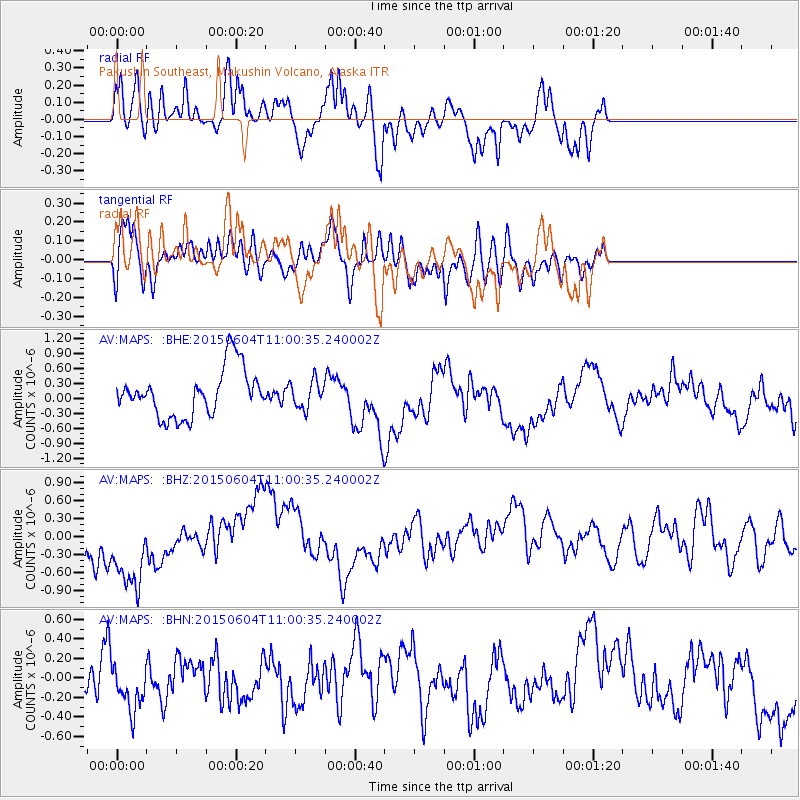
MAPS Pakushin Southeast, Makushin Volcano, Alaska - Earthquake Result Viewer
*The percent match for this event was below the threshold and hence no stack was calculated.
| Earthquake location: |
South Of Mariana Islands |
| Earthquake latitude/longitude: |
13.0/146.1 |
| Earthquake time(UTC): |
2015/06/04 (155) 10:51:36 GMT |
| Earthquake Depth: |
16 km |
| Earthquake Magnitude: |
4.9 MW |
| Earthquake Catalog/Contributor: |
ISC/ISC |
|
| Network: |
AV Alaska Volcano Observatory |
| Station: |
MAPS Pakushin Southeast, Makushin Volcano, Alaska |
| Lat/Lon: |
53.81 N/166.94 W |
| Elevation: |
333 m |
|
| Distance: |
55.0 deg |
| Az: |
31.951 deg |
| Baz: |
240.443 deg |
| Ray Param: |
$rayparam |
*The percent match for this event was below the threshold and hence was not used in the summary stack. |
|
| Radial Match: |
55.183384 % |
| Radial Bump: |
400 |
| Transverse Match: |
59.488857 % |
| Transverse Bump: |
400 |
| SOD ConfigId: |
7422571 |
| Insert Time: |
2019-04-19 05:19:36.430 +0000 |
| GWidth: |
2.5 |
| Max Bumps: |
400 |
| Tol: |
0.001 |
|
Signal To Noise
| Channel | StoN | STA | LTA |
| AV:MAPS: :BHZ:20150604T11:00:35.240002Z | 3.414367 | 8.3895446E-7 | 2.4571304E-7 |
| AV:MAPS: :BHN:20150604T11:00:35.240002Z | 1.275705 | 2.8696127E-7 | 2.2494329E-7 |
| AV:MAPS: :BHE:20150604T11:00:35.240002Z | 0.58289075 | 2.7313507E-7 | 4.6858707E-7 |
| Arrivals |
| Ps | |
| PpPs | |
| PsPs/PpSs | |


