You are here: Home > Network List > TA - USArray Transportable Network (new EarthScope stations) Stations List
> Station O03E Paynes Creek, CA, USA > Earthquake Result Viewer
O03E Paynes Creek, CA, USA - Earthquake Result Viewer
*The percent match for this event was below the threshold and hence no stack was calculated.
| Earthquake location: |
South Of Mariana Islands |
| Earthquake latitude/longitude: |
13.0/146.1 |
| Earthquake time(UTC): |
2015/06/04 (155) 10:51:36 GMT |
| Earthquake Depth: |
16 km |
| Earthquake Magnitude: |
4.9 MW |
| Earthquake Catalog/Contributor: |
ISC/ISC |
|
| Network: |
TA USArray Transportable Network (new EarthScope stations) |
| Station: |
O03E Paynes Creek, CA, USA |
| Lat/Lon: |
40.29 N/121.80 W |
| Elevation: |
967 m |
|
| Distance: |
83.3 deg |
| Az: |
50.32 deg |
| Baz: |
281.211 deg |
| Ray Param: |
$rayparam |
*The percent match for this event was below the threshold and hence was not used in the summary stack. |
|
| Radial Match: |
40.835873 % |
| Radial Bump: |
400 |
| Transverse Match: |
52.827198 % |
| Transverse Bump: |
377 |
| SOD ConfigId: |
7422571 |
| Insert Time: |
2019-04-19 05:22:23.028 +0000 |
| GWidth: |
2.5 |
| Max Bumps: |
400 |
| Tol: |
0.001 |
|
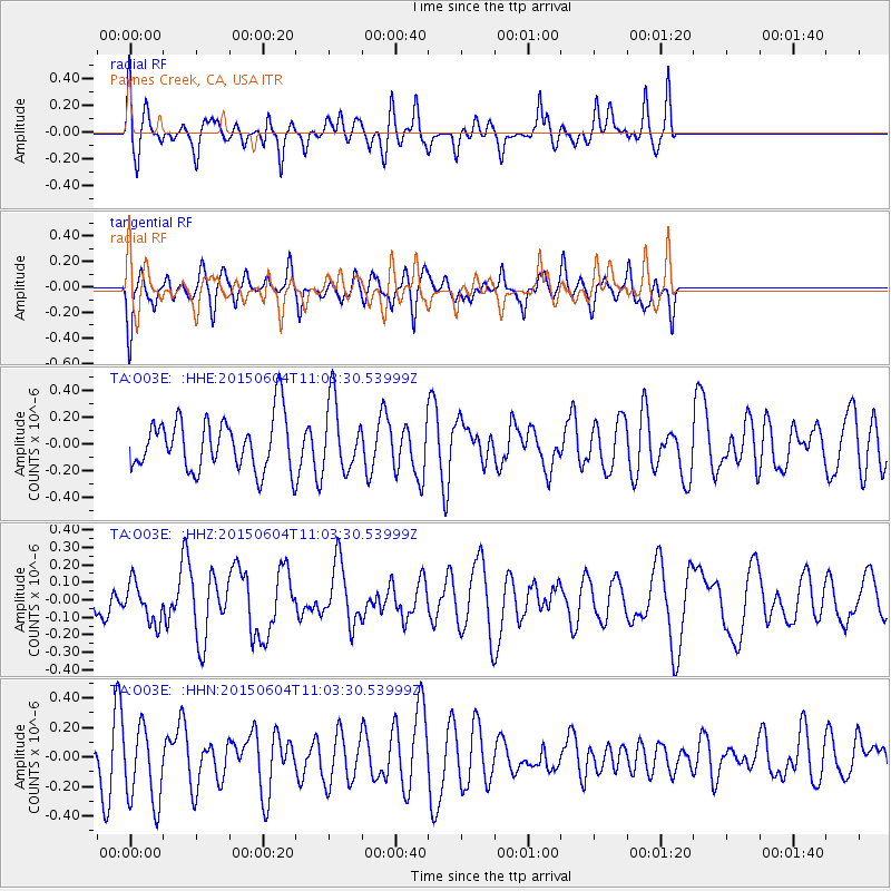
Signal To Noise
| Channel | StoN | STA | LTA |
| TA:O03E: :HHZ:20150604T11:03:30.53999Z | 1.0695091 | 1.1336966E-7 | 1.0600158E-7 |
| TA:O03E: :HHN:20150604T11:03:30.53999Z | 2.1397147 | 2.7246313E-7 | 1.273362E-7 |
| TA:O03E: :HHE:20150604T11:03:30.53999Z | 1.3288879 | 2.5826137E-7 | 1.9434398E-7 |
| Arrivals |
| Ps | |
| PpPs | |
| PsPs/PpSs | |


