You are here: Home > Network List > UW - Pacific Northwest Regional Seismic Network Stations List
> Station MRBL Marblemount, WA, USA > Earthquake Result Viewer
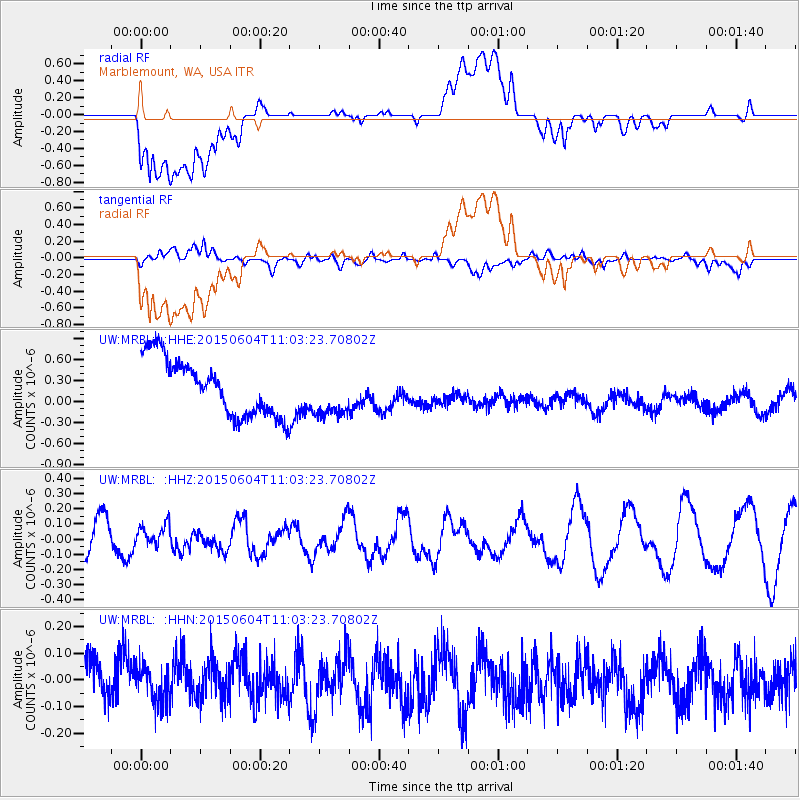
MRBL Marblemount, WA, USA - Earthquake Result Viewer
*The percent match for this event was below the threshold and hence no stack was calculated.
| Earthquake location: |
South Of Mariana Islands |
| Earthquake latitude/longitude: |
13.0/146.1 |
| Earthquake time(UTC): |
2015/06/04 (155) 10:51:36 GMT |
| Earthquake Depth: |
16 km |
| Earthquake Magnitude: |
4.9 MW |
| Earthquake Catalog/Contributor: |
ISC/ISC |
|
| Network: |
UW Pacific Northwest Regional Seismic Network |
| Station: |
MRBL Marblemount, WA, USA |
| Lat/Lon: |
48.52 N/121.48 W |
| Elevation: |
75 m |
|
| Distance: |
82.0 deg |
| Az: |
42.133 deg |
| Baz: |
280.383 deg |
| Ray Param: |
$rayparam |
*The percent match for this event was below the threshold and hence was not used in the summary stack. |
|
| Radial Match: |
52.82682 % |
| Radial Bump: |
400 |
| Transverse Match: |
49.606873 % |
| Transverse Bump: |
400 |
| SOD ConfigId: |
7422571 |
| Insert Time: |
2019-04-19 05:23:00.747 +0000 |
| GWidth: |
2.5 |
| Max Bumps: |
400 |
| Tol: |
0.001 |
|
Signal To Noise
| Channel | StoN | STA | LTA |
| UW:MRBL: :HHZ:20150604T11:03:23.70802Z | 0.5458659 | 7.3209044E-8 | 1.3411544E-7 |
| UW:MRBL: :HHN:20150604T11:03:23.70802Z | 0.61013305 | 6.904832E-8 | 1.13169285E-7 |
| UW:MRBL: :HHE:20150604T11:03:23.70802Z | 0.87504333 | 3.521881E-7 | 4.0248074E-7 |
| Arrivals |
| Ps | |
| PpPs | |
| PsPs/PpSs | |


