You are here: Home > Network List > CN - Canadian National Seismograph Network Stations List
> Station INK INUVIK, NT > Earthquake Result Viewer
INK INUVIK, NT - Earthquake Result Viewer
*The percent match for this event was below the threshold and hence no stack was calculated.
| Earthquake location: |
Borneo |
| Earthquake latitude/longitude: |
6.1/116.5 |
| Earthquake time(UTC): |
2015/06/04 (155) 23:15:43 GMT |
| Earthquake Depth: |
10 km |
| Earthquake Magnitude: |
6.0 MO |
| Earthquake Catalog/Contributor: |
NEIC PDE/NEIC ALERT |
|
| Network: |
CN Canadian National Seismograph Network |
| Station: |
INK INUVIK, NT |
| Lat/Lon: |
68.31 N/133.53 W |
| Elevation: |
44 m |
|
| Distance: |
91.6 deg |
| Az: |
20.467 deg |
| Baz: |
290.726 deg |
| Ray Param: |
$rayparam |
*The percent match for this event was below the threshold and hence was not used in the summary stack. |
|
| Radial Match: |
65.61952 % |
| Radial Bump: |
400 |
| Transverse Match: |
68.14604 % |
| Transverse Bump: |
400 |
| SOD ConfigId: |
7422571 |
| Insert Time: |
2019-04-19 05:25:20.740 +0000 |
| GWidth: |
2.5 |
| Max Bumps: |
400 |
| Tol: |
0.001 |
|
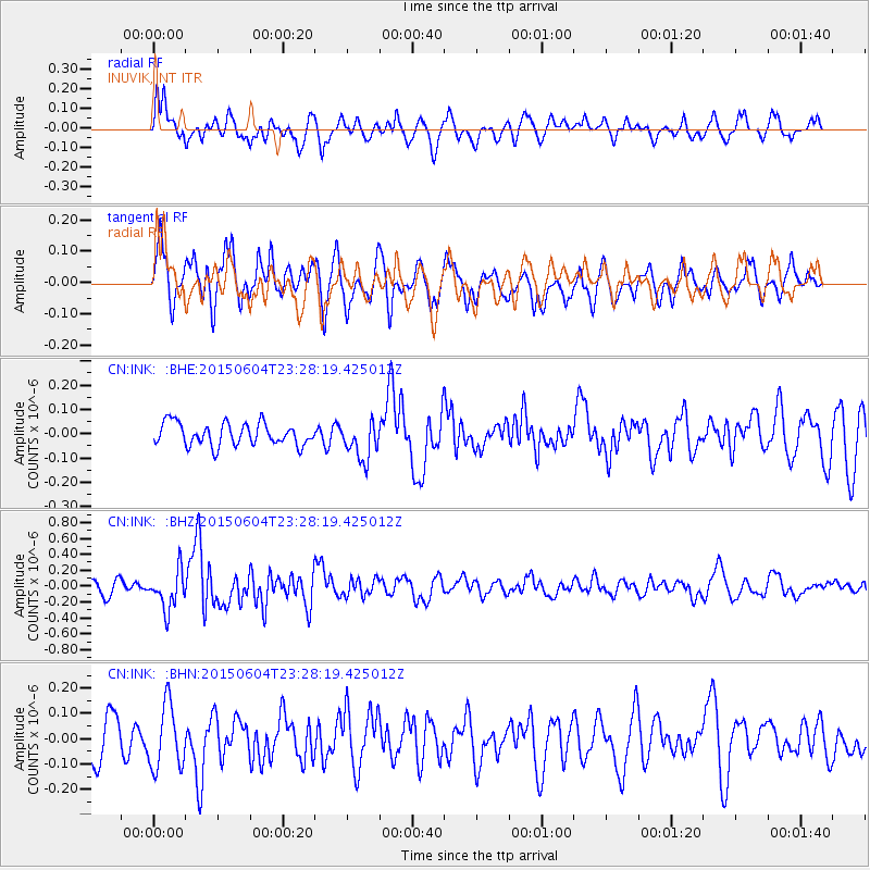
Signal To Noise
| Channel | StoN | STA | LTA |
| CN:INK: :BHZ:20150604T23:28:19.425012Z | 2.0417883 | 2.4430773E-7 | 1.196538E-7 |
| CN:INK: :BHN:20150604T23:28:19.425012Z | 1.3963062 | 1.2713403E-7 | 9.1050254E-8 |
| CN:INK: :BHE:20150604T23:28:19.425012Z | 1.7084907 | 7.8616736E-8 | 4.6015312E-8 |
| Arrivals |
| Ps | |
| PpPs | |
| PsPs/PpSs | |


