CTAO Charters Towers, Australia - Earthquake Result Viewer
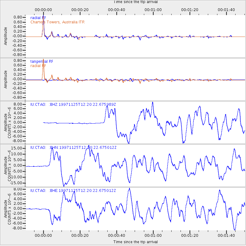
Earthquake location: Minahassa Peninsula, Sulawesi
Earthquake latitude/longitude: 1.2/122.5
Earthquake time(UTC): 1997/11/25 (329) 12:14:33 GMT
Earthquake Depth: 24 km
Earthquake Magnitude: 6.1 MB, 6.8 MS, 7.1 UNKNOWN, 6.7 ME
Earthquake Catalog/Contributor: WHDF/NEIC
Network: IU Global Seismograph Network (GSN - IRIS/USGS)
Station: CTAO Charters Towers, Australia
Lat/Lon: 20.09 S/146.25 E
Elevation: 357 m
Distance: 31.5 deg
Az: 133.587 deg
Baz: 309.605 deg
Ray Param: 0.07903692
Estimated Moho Depth: 38.75 km
Estimated Crust Vp/Vs: 1.73
Assumed Crust Vp: 6.522 km/s
Estimated Crust Vs: 3.775 km/s
Estimated Crust Poisson's Ratio: 0.25
Radial Match: 96.988945 %
Radial Bump: 242
Transverse Match: 75.6679 %
Transverse Bump: 400
SOD ConfigId: 4480
Insert Time: 2010-03-03 14:11:34.223 +0000
GWidth: 2.5
Max Bumps: 400
Tol: 0.001

Signal To Noise

ChannelStoNSTALTA
IU:CTAO: :BHN:19971125T12:20:22.675012Z52.525545.738539E-61.0925236E-7
IU:CTAO: :BHE:19971125T12:20:22.675012Z25.8836252.2233073E-68.589629E-8
IU:CTAO: :BHZ:19971125T12:20:22.675989Z22.3475992.7289109E-61.2211204E-7
Arrivals
Ps4.7 SECOND
PpPs15 SECOND
PsPs/PpSs20 SECOND