
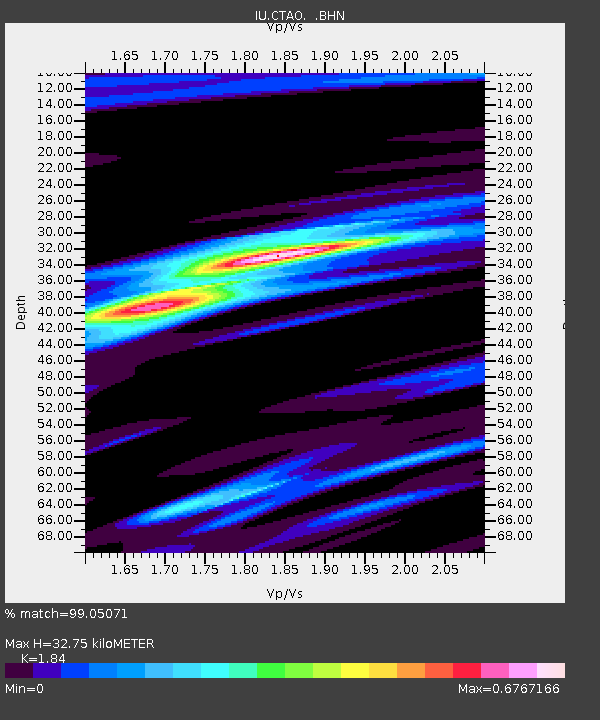
CTAO Charters Towers, Australia - Earthquake Result Viewer
| ||||||||||||||||||
| ||||||||||||||||||
| ||||||||||||||||||
|
Signal To Noise
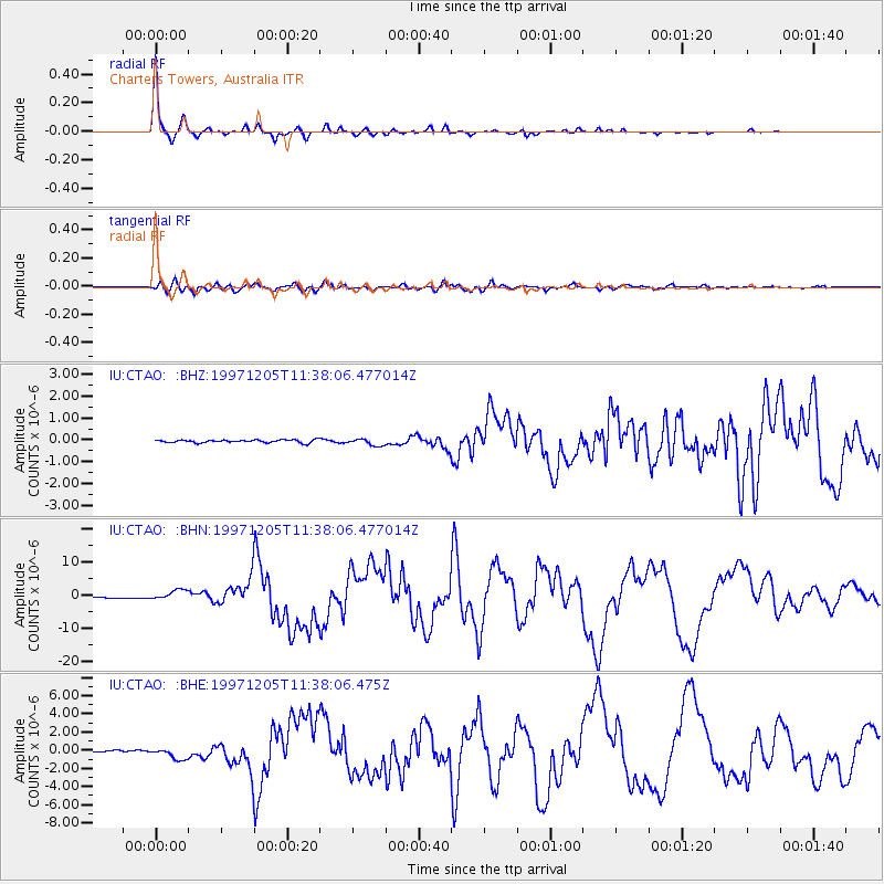
| Channel | StoN | STA | LTA |
| IU:CTAO: :BHN:19971205T11:38:06.477014Z | 13.071391 | 1.5953686E-6 | 1.2205041E-7 |
| IU:CTAO: :BHE:19971205T11:38:06.475Z | 7.869801 | 6.1617874E-7 | 7.829661E-8 |
| IU:CTAO: :BHZ:19971205T11:38:06.477014Z | 2.3691924 | 1.5739617E-7 | 6.6434524E-8 |
| Arrivals | |
| Ps | 4.4 SECOND |
| PpPs | 14 SECOND |
| PsPs/PpSs | 18 SECOND |

