You are here: Home > Network List > AV - Alaska Volcano Observatory Stations List
> Station MAPS Pakushin Southeast, Makushin Volcano, Alaska > Earthquake Result Viewer
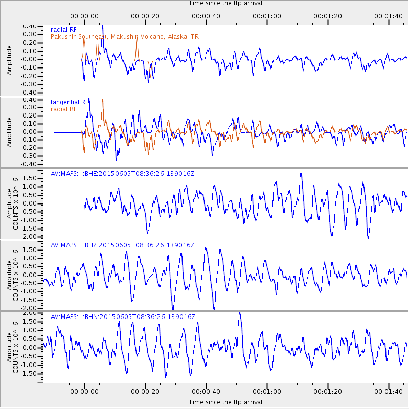
MAPS Pakushin Southeast, Makushin Volcano, Alaska - Earthquake Result Viewer
*The percent match for this event was below the threshold and hence no stack was calculated.
| Earthquake location: |
Kermadec Islands Region |
| Earthquake latitude/longitude: |
-28.9/-175.9 |
| Earthquake time(UTC): |
2015/06/05 (156) 08:24:33 GMT |
| Earthquake Depth: |
10 km |
| Earthquake Magnitude: |
4.9 MW |
| Earthquake Catalog/Contributor: |
ISC/ISC |
|
| Network: |
AV Alaska Volcano Observatory |
| Station: |
MAPS Pakushin Southeast, Makushin Volcano, Alaska |
| Lat/Lon: |
53.81 N/166.94 W |
| Elevation: |
333 m |
|
| Distance: |
82.8 deg |
| Az: |
5.36 deg |
| Baz: |
187.934 deg |
| Ray Param: |
$rayparam |
*The percent match for this event was below the threshold and hence was not used in the summary stack. |
|
| Radial Match: |
61.842316 % |
| Radial Bump: |
400 |
| Transverse Match: |
60.603363 % |
| Transverse Bump: |
400 |
| SOD ConfigId: |
7422571 |
| Insert Time: |
2019-04-19 05:29:38.114 +0000 |
| GWidth: |
2.5 |
| Max Bumps: |
400 |
| Tol: |
0.001 |
|
Signal To Noise
| Channel | StoN | STA | LTA |
| AV:MAPS: :BHZ:20150605T08:36:26.139016Z | 1.2617751 | 5.3804393E-7 | 4.2641824E-7 |
| AV:MAPS: :BHN:20150605T08:36:26.139016Z | 0.46235266 | 2.6069338E-7 | 5.63841E-7 |
| AV:MAPS: :BHE:20150605T08:36:26.139016Z | 1.3057224 | 6.563597E-7 | 5.0267937E-7 |
| Arrivals |
| Ps | |
| PpPs | |
| PsPs/PpSs | |


