CTAO Charters Towers, Australia - Earthquake Result Viewer
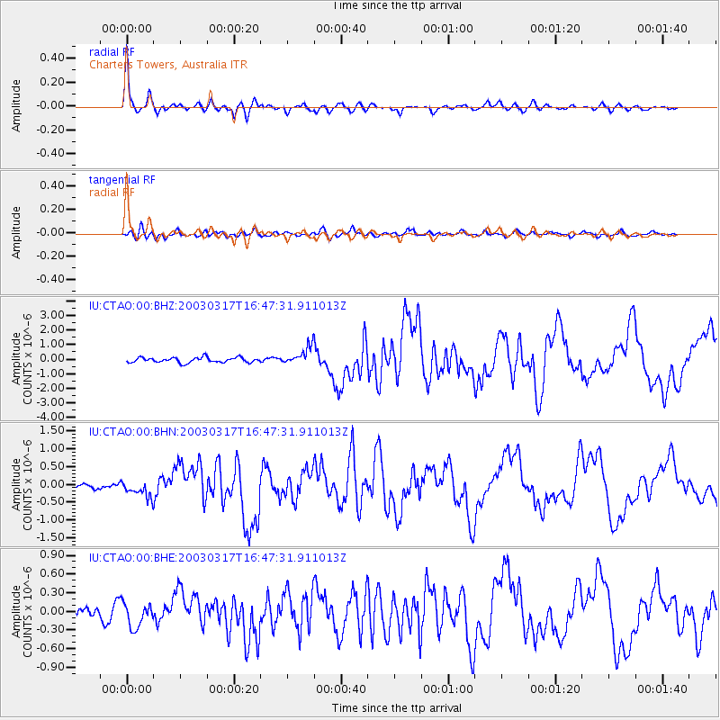
Earthquake location: Rat Islands, Aleutian Islands
Earthquake latitude/longitude: 51.3/178.0
Earthquake time(UTC): 2003/03/17 (076) 16:36:17 GMT
Earthquake Depth: 33 km
Earthquake Magnitude: 5.9 MB, 6.7 MS, 7.0 MW, 7.0 MW
Earthquake Catalog/Contributor: WHDF/NEIC
Network: IU Global Seismograph Network (GSN - IRIS/USGS)
Station: CTAO Charters Towers, Australia
Lat/Lon: 20.09 S/146.25 E
Elevation: 357 m
Distance: 76.3 deg
Az: 210.574 deg
Baz: 19.874 deg
Ray Param: 0.051029123
Estimated Moho Depth: 39.75 km
Estimated Crust Vp/Vs: 1.68
Assumed Crust Vp: 6.522 km/s
Estimated Crust Vs: 3.876 km/s
Estimated Crust Poisson's Ratio: 0.23
Radial Match: 95.2897 %
Radial Bump: 351
Transverse Match: 71.86809 %
Transverse Bump: 400
SOD ConfigId: 4714
Insert Time: 2010-03-03 14:12:58.272 +0000
GWidth: 2.5
Max Bumps: 400
Tol: 0.001

Signal To Noise

ChannelStoNSTALTA
IU:CTAO:00:BHN:20030317T16:47:31.911013Z1.93352282.3289292E-71.2045004E-7
IU:CTAO:00:BHE:20030317T16:47:31.911013Z1.05588161.9378697E-71.8353096E-7
IU:CTAO:00:BHZ:20030317T16:47:31.911013Z3.64353376.178929E-71.6958617E-7
Arrivals
Ps4.3 SECOND
PpPs16 SECOND
PsPs/PpSs20 SECOND