CTAO Charters Towers, Australia - Earthquake Result Viewer
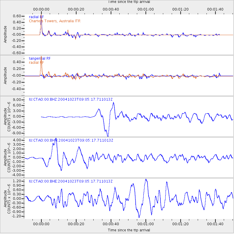
Earthquake location: Near West Coast Of Honshu, Japan
Earthquake latitude/longitude: 37.2/138.8
Earthquake time(UTC): 2004/10/23 (297) 08:56:00 GMT
Earthquake Depth: 16 km
Earthquake Magnitude: 6.4 MB, 6.3 MS, 6.6 MW, 6.4 MW
Earthquake Catalog/Contributor: WHDF/NEIC
Network: IU Global Seismograph Network (GSN - IRIS/USGS)
Station: CTAO Charters Towers, Australia
Lat/Lon: 20.09 S/146.25 E
Elevation: 357 m
Distance: 57.4 deg
Az: 171.658 deg
Baz: 352.922 deg
Ray Param: 0.06347596
Estimated Moho Depth: 34.75 km
Estimated Crust Vp/Vs: 1.76
Assumed Crust Vp: 6.522 km/s
Estimated Crust Vs: 3.711 km/s
Estimated Crust Poisson's Ratio: 0.26
Radial Match: 97.11272 %
Radial Bump: 300
Transverse Match: 87.585335 %
Transverse Bump: 400
SOD ConfigId: 2459
Insert Time: 2010-03-03 14:13:22.007 +0000
GWidth: 2.5
Max Bumps: 400
Tol: 0.001

Signal To Noise

ChannelStoNSTALTA
IU:CTAO:00:BHN:20041023T09:05:17.711013Z8.606831.0823154E-61.2575077E-7
IU:CTAO:00:BHE:20041023T09:05:17.711013Z1.47285871.3623342E-79.2495924E-8
IU:CTAO:00:BHZ:20041023T09:05:17.711013Z17.1580052.256431E-61.3150894E-7
Arrivals
Ps4.3 SECOND
PpPs14 SECOND
PsPs/PpSs18 SECOND