You are here: Home > Network List > UW - Pacific Northwest Regional Seismic Network Stations List
> Station UMAT Pilot Rock, OR, USA > Earthquake Result Viewer
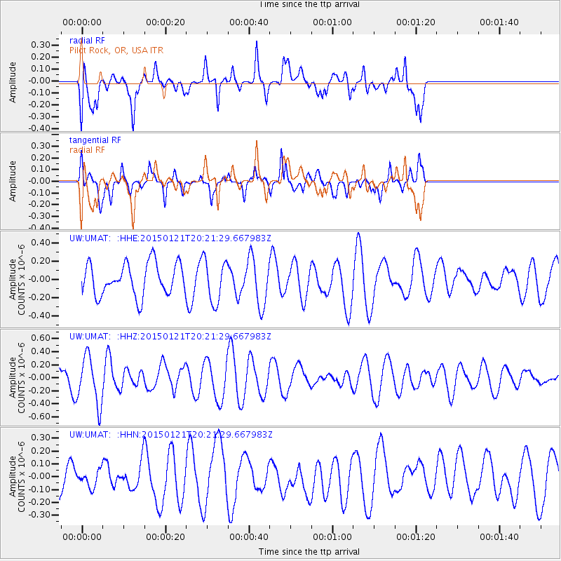
UMAT Pilot Rock, OR, USA - Earthquake Result Viewer
*The percent match for this event was below the threshold and hence no stack was calculated.
| Earthquake location: |
Eastern New Guinea Reg., P.N.G. |
| Earthquake latitude/longitude: |
-5.6/146.3 |
| Earthquake time(UTC): |
2015/01/21 (021) 20:08:33 GMT |
| Earthquake Depth: |
49 km |
| Earthquake Magnitude: |
5.7 MB |
| Earthquake Catalog/Contributor: |
NEIC PDE/NEIC COMCAT |
|
| Network: |
UW Pacific Northwest Regional Seismic Network |
| Station: |
UMAT Pilot Rock, OR, USA |
| Lat/Lon: |
45.29 N/118.96 W |
| Elevation: |
1318 m |
|
| Distance: |
97.3 deg |
| Az: |
45.174 deg |
| Baz: |
269.37 deg |
| Ray Param: |
$rayparam |
*The percent match for this event was below the threshold and hence was not used in the summary stack. |
|
| Radial Match: |
61.40361 % |
| Radial Bump: |
400 |
| Transverse Match: |
61.53414 % |
| Transverse Bump: |
400 |
| SOD ConfigId: |
837871 |
| Insert Time: |
2015-02-04 20:40:04.934 +0000 |
| GWidth: |
2.5 |
| Max Bumps: |
400 |
| Tol: |
0.001 |
|
Signal To Noise
| Channel | StoN | STA | LTA |
| UW:UMAT: :HHZ:20150121T20:21:29.667983Z | 2.8712804 | 3.7108754E-7 | 1.2924113E-7 |
| UW:UMAT: :HHN:20150121T20:21:29.667983Z | 0.5463068 | 6.371112E-8 | 1.166215E-7 |
| UW:UMAT: :HHE:20150121T20:21:29.667983Z | 1.3501146 | 2.3704385E-7 | 1.7557312E-7 |
| Arrivals |
| Ps | |
| PpPs | |
| PsPs/PpSs | |


