
CTAO Charters Towers, Australia - Earthquake Result Viewer
| ||||||||||||||||||
| ||||||||||||||||||
| ||||||||||||||||||
|
Signal To Noise
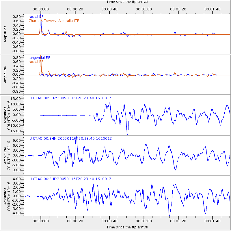
| Channel | StoN | STA | LTA |
| IU:CTAO:00:BHN:20050116T20:23:40.161001Z | 13.182515 | 1.527636E-6 | 1.1588349E-7 |
| IU:CTAO:00:BHE:20050116T20:23:40.161001Z | 2.9677696 | 3.3555895E-7 | 1.1306773E-7 |
| IU:CTAO:00:BHZ:20050116T20:23:40.161001Z | 17.961706 | 2.7062954E-6 | 1.5067027E-7 |
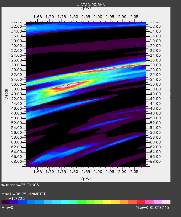
| Arrivals | |
| Ps | 4.7 SECOND |
| PpPs | 14 SECOND |
| PsPs/PpSs | 19 SECOND |

