You are here: Home > Network List > TA - USArray Transportable Network (new EarthScope stations) Stations List
> Station M53A WI Miller and Sons, Farmdale, OH, USA > Earthquake Result Viewer
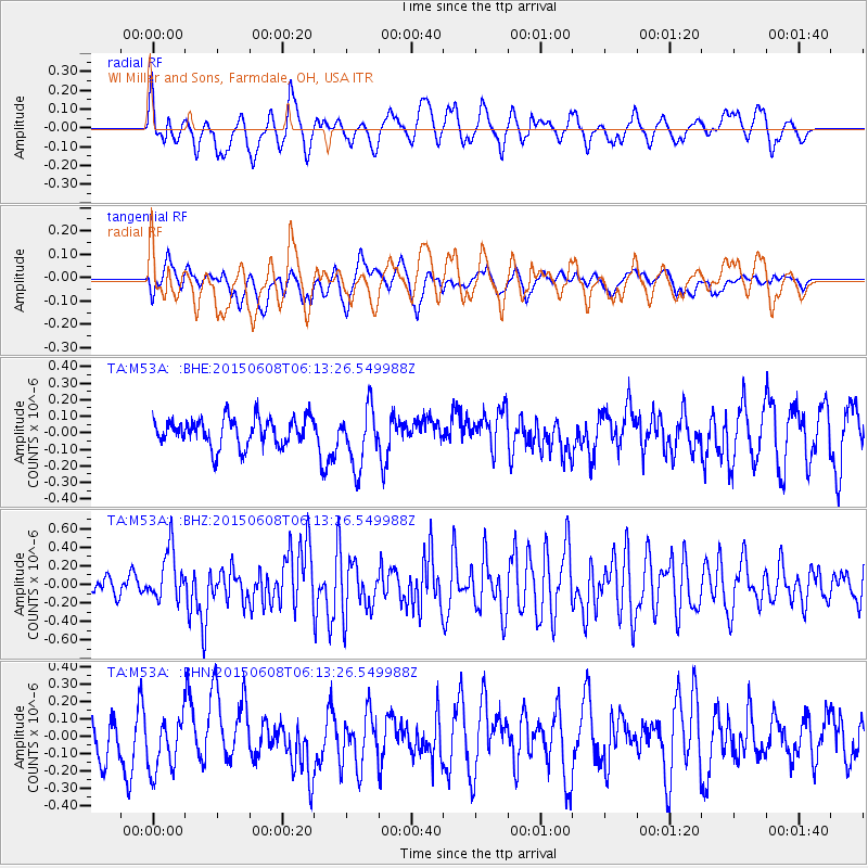
M53A WI Miller and Sons, Farmdale, OH, USA - Earthquake Result Viewer
*The percent match for this event was below the threshold and hence no stack was calculated.
| Earthquake location: |
Hokkaido, Japan Region |
| Earthquake latitude/longitude: |
41.5/142.0 |
| Earthquake time(UTC): |
2015/06/08 (159) 06:01:08 GMT |
| Earthquake Depth: |
44 km |
| Earthquake Magnitude: |
6.2 MO |
| Earthquake Catalog/Contributor: |
NEIC PDE/NEIC ALERT |
|
| Network: |
TA USArray Transportable Network (new EarthScope stations) |
| Station: |
M53A WI Miller and Sons, Farmdale, OH, USA |
| Lat/Lon: |
41.44 N/80.68 W |
| Elevation: |
334 m |
|
| Distance: |
88.9 deg |
| Az: |
30.616 deg |
| Baz: |
329.394 deg |
| Ray Param: |
$rayparam |
*The percent match for this event was below the threshold and hence was not used in the summary stack. |
|
| Radial Match: |
65.90753 % |
| Radial Bump: |
400 |
| Transverse Match: |
47.108276 % |
| Transverse Bump: |
400 |
| SOD ConfigId: |
7422571 |
| Insert Time: |
2019-04-19 05:54:23.061 +0000 |
| GWidth: |
2.5 |
| Max Bumps: |
400 |
| Tol: |
0.001 |
|
Signal To Noise
| Channel | StoN | STA | LTA |
| TA:M53A: :BHZ:20150608T06:13:26.549988Z | 3.0130365 | 2.7379212E-7 | 9.086917E-8 |
| TA:M53A: :BHN:20150608T06:13:26.549988Z | 1.4502413 | 1.6537223E-7 | 1.1403084E-7 |
| TA:M53A: :BHE:20150608T06:13:26.549988Z | 2.1425364 | 1.7867879E-7 | 8.339592E-8 |
| Arrivals |
| Ps | |
| PpPs | |
| PsPs/PpSs | |


